
This battery was part of Dearing’s Battalion, which served as a member of Pickett’s Division in the First Corps, Army of Northern Virginia. The Battalion commander was Major James Dearing (April 25, 1840 – April 22, 1865) who was a Confederate States Army officer during the American Civil War. He was mortally wounded at the Battle of High Bridge during the Appomattox Campaign, making him one of the last officers to die in the war; there are claims that he was the last general officer to die in the war. This battery (the subject of this waymark) was commanded by Captain William H. Caskie (1834-1900). William Henderson Caskie was a Richmond businessman. After the War, he was a noted newspaper cartoonist, actor, and painter in Texas.
The Caskie's Hampden Artillery CS Battery Tablet is southwst of Gettysburg on West Confederate Avenue. The monument is on West Confederate Avenue, (160 feet past the exit of Amphitheater Road), on the left when traveling south.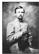 The monument faces the west, opposite Pitzer Woods. Parking can be had at the side of the road at small, intermittently placed cutouts or you can park along Amphitheater where there are lots of parking slots. Please do not park on the grass, park on the side of the road. I cannot emphasize that enough! You will be ticketed. I visited this monument on Saturday, March 10, 2012 at 3:14 PM, just before the clocks were set ahead for the Spring. I was at a 604 foot ASL elevation.
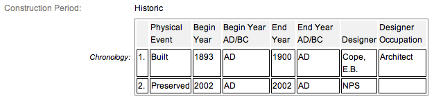
These monuments were first built in 1900 and concluded in 1906 according to the NRHP nomination form. Some sites have the monuments being erected in 1912 or 1911; the NRHP also has this specific one at 1893 so you know they were smoking something when they wrote the narrative for this tablet. It is amazing with all the work and effort exerted to make the Gettysburg National Military Park a reality, no one took the time to keep accurate records and correct installation dates. The work was done under the direction of the Gettysburg National Park Commission (established by the United States Department of War), after they took over the administration of the park from the Gettysburg Battlefield Memorial Association (whose funds had expired) on March 3, 1893, and whose stewardship was then transferred to the National Park Service in 1933 SOURCE.
Draw the Sword, with descriptive help from the NPS site, offers the following description: Cast iron tablet, 3’8? x 3’4?, with raised inscription painted in a contrasting color and mounted on fluted cast iron post. All 4’4? H. Tablets casts by Calvin Gilbert. The inscription on the 3.8' x 3.4' tablet narrates the events associated with Battery during the Battle.
Army of Northern Virginia
Longstreet's Corps Pickett's Division
Dearing's Battalion Caskie's Battery
The Hampden Artillery
One 10 pounder Parrott, One 3 inch Rifle
and Two Napoleons
July 3 Advanced to the front about daylight. Later in the morning took position on the ridge west of the Emmitsburg road and near the Rogers House remaining for hours unengaged. When the signal guns were fired about 1 p.m. moved forward to the crest of the hill and took an active part in the cannonade. Ammunition was exhausted while Longstreet's column was advancing the last rounds being fired at the Union infantry which assailed his right flank. Efforts to procure a fresh supply of ammunition proving unsuccessful the Battery was withdrawn.
July 4 In line of battle all day whith the left wing of McLaws's Division. Marched at sunset to Black Horse Tavern.
Losses not reported in detail.
There are scores of similar monuments for the various Confederate States & Union units which fought at Gettysburg. Four designs represent brigade, division, corps and army headquarters, and each has elements which identify it as Union or Confederate. Many of the tablets were created by Albert Russell & Sons Co. of Newburyport, Massachusetts and are made of granite, bronze and concrete or like this one, cast iron. All of these tablets were designed by architect E.B. Cope. He designed pretty much every tablet for both the Union and Confederate armies, each one distinct, with several different varieties. The monuments were erected just after the turn of the century during the first and beginning of the second decade of the 20th century. Each one has since been preserved or restored at least twice since the turn of the 21st century. The plaques and tablets were erected by the Gettysburg Park Commission (established by the War Department). The Gettysburg Park Commission is also referred to as the Gettysburg National Military Park Commission or the Gettysburg National Park Commission, to clear up any confusions, especially my own.
On October 1, 1898, the Gettysburg National Park Commission in a letter to the Secretary of War set gave recommendations for continuing the task of organizing and progressing the work of the Gettysburg National Military Park. Every November they wrote their annual report which outlined the work of the GNPC for that year. The following is an excerpt from that report relevant to this waymark. The link at the end of the paragraph will take you to the entire report. The method of marking the positions of troops on this field, as approved by the War Department, is to place the principal tablet or monument of each command at the position occupied by the command in the main line of battle, and to mark the several important positions subsequently reached by each command in the course of the battle by subordinate and ancillary tablets, with appropriate brief inscriptions giving interesting details and occurrences and noting the day and hour as nearly as possible. SOURCE
Information about these specific types of monuments:
CONFEDERATE BATTERY AND BRIGADE TABLETS (ADVANCED POSITION)
These tablets are 3’8" x 3’4" in dimensions, with carefully prepared inscriptions cast in raised letters painted in white (contrasting the black background) describing the part taken in the battle by each brigade, their position and stating its numbers and losses so far as practicable to obtain. They are mounted on iron pillars or fluted cast iron posts about 3 feet high, grouted in the ground, and the tablets are inclined at a suitable angle so that the inscriptions can easily be read by persons riding or driving on the avenue. Every tablet is 4’4" in height. The advance position markers were cast by Calvin Gilbert. SOURCE & SOURCE
The Caskie's Hampden Artillery - CS Battery Marker is a contributing feature to the Gettysburg National Military Park Historic District which is nationally significant under NR Criteria A, B, C & D. Areas of Significance: Military, Politics/Government, Landscape Architecture, Conservation, Archeology-Historic. Period of Significance: 1863-1938. The original National Register Nomination was approved by the Keeper March 19, 1975. An update to this nomination was approved by the Keeper on January 23, 2004. The monument is identified as structure number MN575-B.
From the Nomination Form:
Civil War tablet that marks position of Caskie's Hampden Artillery CS Battery on July 3-4, 1863. Narrates events associated w/ Battery during Battle.
Short Physical Description:
MN & 2 Cannons. Cast iron tablet, 3'8" x 3'4", with raised inscription painted in a contrasting color and mounted on fluted cast iron post. All 4'4" H. Cast by C. Gilbert. Cannons on N/S sides of tablet.
Long Physical Description:
Located on E side of West Confederate Avenue, N of Millerstown Road, opposite Pitzer Woods. Cannon pads only remain, the cannons have been removed.
My Sources
1.
NRHP Nomination Form
2.
Stone Sentinels
3.
Virtual Gettysburg
4.
Draw the Sword
5.
Historical Marker Database
6.
Antietam on the Web