
The Gettysburg Military Park Commission or whatever the equivalent of the National Park Service was in approximately 1900 (I think it was the War Department) took an inventory of all the existing monuments in the eventual historic district. I have found hundreds of these pictures on Virtual Gettysburg, a comprehensive website which pictorially inventories all the monuments, providing a text of all inscriptions and minor narratives. All the photos look the same as if they were taken by the same camera and in the same approximate time period. Even the angles are all the same, positioning the monument at a slight right angle, revealing a little of the left part of the monument. The entire park looks so young and immature when the photos were taken. After all, the Battle of Gettysburg was thirty-seven years old at the time and war veterans were only in their fifties. I have never been able to find any photo credits but I know they are public domain. This picture can be found HERE.
Clearly it is evident, through a survey of historical pictures and other archival information, much change has occurred at Gettysburg Battlefield. With the passage of legislation affording historical status to this site as well as placing it under the auspices of the National Park Service, its patrons and caretakers had to groom and prepare the area to make it more authentic as well as educational. Today the battlefield has managed to maintain an authentic 1863 feel, but back then, as evident in the many photos, it was a desolate, empty place of green fields broken only by the occasional farmstead, their outbuildings and fields of crops. With the emergence and dedication of hundreds of monuments since 1900, and the development of farmland, some change has occurred but nothing too dramatic. After 120 years, these two pics are still pretty darn close and line up nicely. The only difference is the maturation of the trees and greenery to the rear of the monument. Everything is much thicker and as a result, there is a wall of nature, not so in the turn-of-the-century picture. The park in the 1890 picture looks like a marshy, swampland not fit to walk. Of course, back when this monument was installed, the roads had not all been constructed yet.
The monument is located on the west side of Slocum Avenue, near Pardee Field, near Culp's Hill, in a much higher elevation than the other surrounding monuments. The monument faces the east so I faced west when I snapped my picture, approximately 10 feet away, capturing the monument straight on. My picture was taken Friday, July 15th, 2011 @ 4:10 PM (EST) at an elevation of 550 feet ASL whilst on Summer Break from teaching. I used my General Electric 10.1 megapixel model # A1050 digital camera.
From a previous waymark about this monument:
** The complete picture gallery for this monument can be found HERE. **
The 29th Pennsylvania Infantry was also known as The Jackson Regiment. During the battle of Gettysburg, it served as a member of Kane’s Brigade in Geary’s Division of the Twelfth Corps, Army of the Potomac and was commanded by Col. William Rickards (1824-1900). He was a Jewelry manufacturer in Philadelphia; wounded at First Winchester and at Lost Mountain. He then became a dentist after the War. After an exhaustive search on the internet I discovered I'd have to visit my library to learn anything more about this Colonel. The regiment brought 485 men to the field, losing 15 killed, 43 wounded and 8 missing.
The 29th Pennsylvania Infantry Monument is located on the west side of Slocum Avenue, near Pardee Field, near Culp's Hill. The Draw the Sword site helped out by the NPS narrative and the SIRIS site offers the following description: Sculpture: granite with bronze elements; Base: granite. Sculpture consists of a shaft, pedestal and two-tiered base. The pedestal and top tier are polished and the bottom tier and most of the shaft are rough-hewn. There are relief muskets on each corner of the shaft. The whole is surmounted by a bronze eagle perching on a bronze sphere over the 12th Corps star insignia. A square relief with the Pennsylvania State Seal is affixed to the pedestal at the front. Monument is a four-part stepped granite shaft topped with a bronze star corps symbol and a soaring eagle on a partial sphere and set on a 5.6 foot rough cut base. It has polished and smooth finished faces with incised inscriptions and a bronze trophy on the lower three parts. The fourth (upper) part of the shaft is rough and smooth cut. Overall height is 16.3 feet. The eagle in some of the pictures I found is missing an in others is present. A few years ago it was removed for service but I also think it was vandalized at one time but that might be why it was removed.
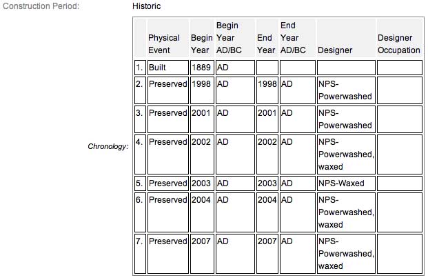
The sculpture indicates the position held and fortified by the 29th Pennsylvania Infantry on the morning of July 2, 1863 and retaken morning July 3, 1863. The monument was dedicated on July 11, 1889 by the Commonwealth of Pennsylvania. The monument has the following composition: Sculpture: granite with bronze elements; Base: granite.
and was fabricated by John M. Gessler & Sons. It has the following dimensions: Sculpture: approx. H. 16 ft. 3 in.; Base: approx. W. 5 ft. 6 in. x D. 5 ft. 6 in. The inscription on the three sides read:
 (Front):July 2. Position of the Regiment. at 7 p.m.
the Brigade was withdrawn, and on returning
during the night found the enemy in these works
the Regiment took position in rear of this line
with its right as indicated by the tablet
erected to the left and rear; and from there
a charge of the enemy at day light of the 3rd
was repulsed after a contest of over seven hours
in which the regiment participated it reoccupied and
held the works until the close of the battle.(Left):Recruited in Philadelphia
Mustered in July 1861.
Re-enlisted Dec. 8, 1863.
Mustered out July 17, 1865.(Right):Present at Gettysburg, 485
Killed 15
Wounded 43
Captured or Missing 8
The 29th Pennsylvania Infantry Monument is a contributing feature to the Gettysburg National Military Park Historic District which is nationally significant under NR Criteria A, B, C & D. Areas of Significance: Military, Politics/Government, Landscape Architecture, Conservation, Archeology-Historic. Period of Significance: 1863-1938. The original National Register Nomination was approved by the Keeper March 19, 1975. An update to this nomination was approved by the Keeper on January 23, 2004. The monument is identified as structure number MN346-B.
From the Nomination Form:
1 of 110 Civil War Monuments to Pennsylvania of the GBMA Era (1863 - 1895) . Indicates position held morning July 2, 1863, retaken morning July 3, 1863. LF&RF markers located 60'&50' N-S of Mn, respectively. Mn located W side Slocum Avenue, near Pardee Field.
Short Physical Description:
Mn & 2 flanking markers. Base 5'6"sq rough-cut. 4 part stepped shaft. Polished & smooth finish faces w/ incised inscriptions, bronze trophy 1st 3 parts. 4th: rough-& smooth-cut. Top star Corps symbol, soaring eagle cap, vandalized & removed. All 16'3"H
Long Physical Description:
Monument that has two flanking markers. Monument is a four-part stepped granite shaft topped with a bronze star corps symbol and a soaring eagle on a partial sphere and set on a 5.6 foot rough cut base. It has polished and smooth finished faces with incised inscriptions and a bronze trophy on the lower three parts. The fourth (upper) part of the shaft is rough and smooth cut. Overall height is 16.3 feet. Located on the west side of Slocum Avenue, near Pardee Field.
My Sources
1.
Draw the Sword
2.
SIRIS
3.
Virtual Gettysburg
4.
Historical Marker Database
5.
Stone Sentinels
6.
NRHP Narrative