
Borah Peak Earthquake Scarps
Posted by:  Volcanoguy
N 44° 09.849 W 113° 52.092
12T E 270676 N 4894105
Borah Peak Earthquake Scarps on Double Springs Pass Road.
Waymark Code: WMC5CM
Location: Idaho, United States
Date Posted: 07/27/2011
Views: 9
This is a visitor information site on the Double Springs Pass Road about two and a half miles northeast of U.S. Hwy. 93. There are restrooms, parking lot, and interpretive signs at the location.
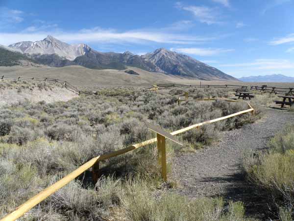
At 8:06 a.m., Friday, October 28, 1983, an earthquake measuring 7.3 on the Richter scale rocked this area. The quake was centered about 7 miles south southeast of here. It was the worst earthquake to hit Idaho in a century and the most severe in the Mountain West since 1959. The earthquake toppled buildings, sent boulders crashing into homes (killed two children in Challis, Idaho), released new springs and geysers, and caused an estimated $12.5 million in damage in sparsely-populated Custer and Butte Counties. This 21 miles long scarp is a haunting reminder of that day.
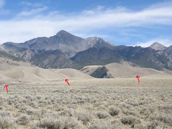
A segment of the fault scarp marked by arrows.
Some photos at the scarp.
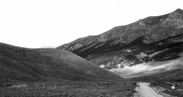
Before photo (USGS) along Double Springs Pass Road in 1979.
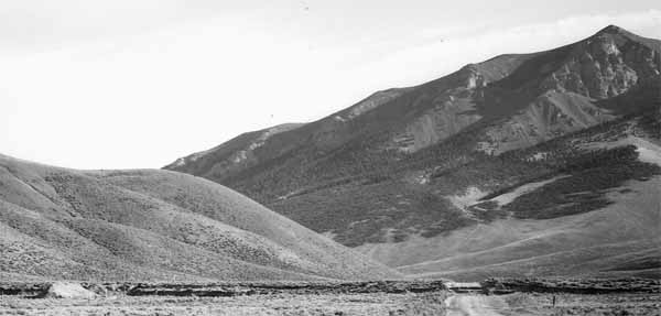
After photo (USGS) along Double Springs Pass Road in 1983.
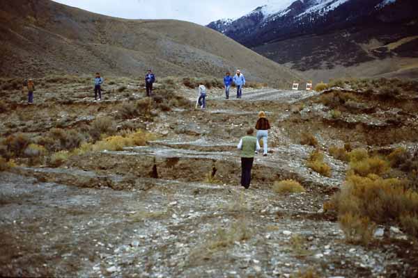
Nov. 5, 1983 photo by Volcanoguy at fault scarp on Double Springs Pass Road.
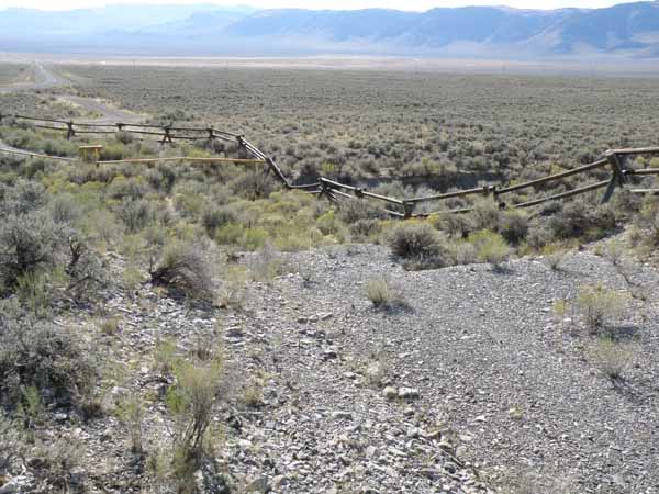
Sept. 24, 2010 photo by Volcanoguy at fault scarp on Double Springs Pass Road.
Historic photos:
U.S. Geological Survey
Idaho Geological Survey
University of Utah
The following comes from Forest Service brochure
There is a great deformation called the Western Cordillera (principal mountain range of a continent) that runs from the southern tip of Chile to Alaska. The Lost River Range in Idaho, rising over 6,000 feet above the valley floor, is in the central portion of the Cordillera. The Idaho Batholith lies to the west and the Overthrust Belt to the east.
The Lost River Range is a triple-ridge range. Borah Peak (12,662 feet) is in the central ridge and is the highest point in Idaho. Most of the rocks that outcrop in the range consist of lithified ocean sediments, even to the top of Borah Peak. It is possible to collect bivalve shells and corals from many locations in the Lost River Range, including peaks more than 12,000 feet above sea level.
The Lost River Range is composed of Paleozoic and Precambrian sedimentary rocks, complexly folded and thrust faulted during the Mesozoic Era. Much of the present topography of the Lost River Range is probably from displacement from the late Pliocene and Pleistocene Epochs. Over the last 5 million years there has been over 8,000 feet of displacement on the Lost River Fault, forming the Lost River Range and spectacular Borah Peak.
In the 1930’s, Dr. Richter developed a system that was useful in the State of California to recognize variations in the energy released during an earthquake. The system has been used in the United States ever since. Each whole number is 10 times the energy release of the next smaller number; hence a Richter 5 earthquake has 10 times more energy than a Richter 4 earthquake. A Richter 7 earthquake has 1,000 times more energy than a Richter 4 earthquake.
In 1983, a 7.3 earthquake formed a new rupture which followed an ancient scarp near the base of Borah Peak. The principal movement of the new rupture was up and down. The angle at the break is 60° to 80° and is called a “high angle
dip slip fault.” Most of the active faults in the Intermountain Region are “high angle dip slip faults” that have moved one or more times during the past 10,000 years.
The 1983 earthquake also caused new springs and sand cones to develop north and east of Chilly Buttes (west of Highway 93 in Thousand Springs Valley). Sand cones are groundwater eruptions that develop a cone or tubular orifice. The geyser brings sand from the subsurface to form a low cone. Some of the new springs will be active for several years.
In the 1970’s, geologists recognized that the existing scarp at the foot of Borah Peak was as high and fresh as any other along the 100-mile-long Lost River fault and might be the site of a future earthquake. Not only did that earthquake occur, but the new scarp created by the 1983 Borah Peak earthquake is identical to its predecessor. The scarp is now twice its former height and 21 miles long.
The Lost River fault thus created two nearly identical earthquakes during the past two ruptures at Thousand Springs Valley. But are all ruptures of the fault at the Valley similar to the 1983 event? Borah Peak now stands one and one-half mile above the deepest deposits in the valley, although they are composed of the same rock and once stood at the same level. If each earthquake increased the separation between Borah Peak and the Valley by six feet, then a Borah Peak earthquake must have struck 1,500 times since the birth of the fault about five million years ago.