
Burn Falls - Oregon
Posted by:  Volcanoguy
N 43° 43.053 W 121° 21.842
10T E 631783 N 4841802
A small waterfall on Paulina Creek above McKay Crossing Campground.
Waymark Code: WMBJR7
Location: Oregon, United States
Date Posted: 05/27/2011
Views: 3
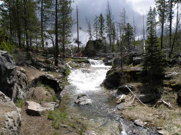
This 10-foot falls is located on Paulina Creek, about a half mile upstream from McKay Crossing Campground, at an elevation of about 4850 feet. The falls consist of two segments separated by a small pool. The upper segment is a 4-foot plunge and the the lower 6-foot cascade. No official name, I refer to it as Burn Falls because it is located near the west edge of the 1998 McKay Butte Burn. No official trail or viewpoint but user trails lead to various views. Can be accessed from Peter Skene Ogden Trail on north side of creek.
?Paulina Creek is undersized for the features found along the channel, it’s average annual discharge is 18 cubic feet per second. Between 2000 and 4000 years ago a small waterfall reached Paulina Lake and dropped the lake’s level by about 8 feet. This resulted in a flood with an estimated discharge rate of about 7000 cubic feet per second (almost 400 times the annual rate). The flood lasted no more than two days. This flood formed the many large scale features found along Paulina Creek, like the large gravel bars upstream from here.
Please include a picture at Burn Falls when you log this waymark.