
Lower McKay Falls - Oregon
Posted by:  Volcanoguy
N 43° 43.046 W 121° 23.262
10T E 629877 N 4841752
Falls on Paulina Creek below McKay Crossing Falls.
Waymark Code: WMBJP7
Location: Oregon, United States
Date Posted: 05/27/2011
Views: 3
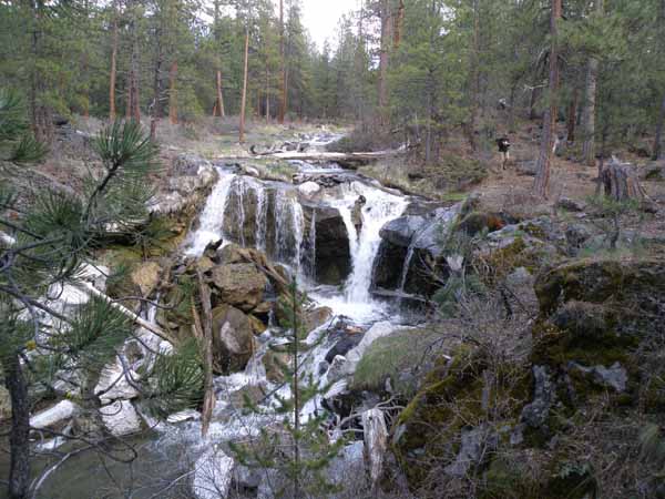
This 15-foot falls is located on Paulina Creek about a half mile downstream from McKay Crossing Campground, at an elevation of about 4600 feet. No official name, I refer to it as Lower McKay Falls. No official trail or viewpoint but user trails lead to various views. No easy access from Peter Skene Ogden Trail to the north but it can be accessed easily from Rd. 2120 to the south.
Paulina Creek is undersized for the features found along the channel, it’s average annual discharge is 18 cubic feet per second. Between 2000 and 4000 years ago a small waterfall reached Paulina Lake and dropped the lake’s level by about 8 feet. This resulted in a flood with an estimated discharge rate of about 7000 cubic feet per second (almost 400 times the annual rate). The flood lasted no more than two days. This flood formed the many large scale features found along Paulina Creek.
Please include a picture at Lower McKay Falls when you log this waymark.