
Pittsburg, NH
Posted by:  silverquill
N 45° 03.089 W 071° 23.219
19T E 312037 N 4991441
Pittsburg, NH, includes the entire north tip of the state of New Hampshire, but has a population of only about 300. The headwaters of the Connecticut River are hear near the Canadian border north of the four Connecticut Lakes.
Waymark Code: WMBJ3N
Location: New Hampshire, United States
Date Posted: 05/24/2011
Views: 11
This welcome sign is actually in the center of town. It depicts the things that this northern part of New Hampshire is famous for - mountains and streams, covered bridges, fall foliage, and, of course, moose. The highway leading north of here to the Canadian border is known as "Moose Alley."
BR>
PITTSBURG, NEW HAMPSHIRE
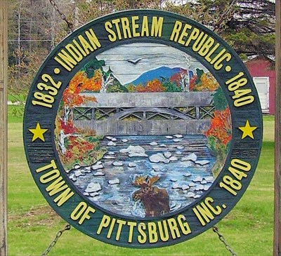
Originally known as Indian Stream, Pittsburg is distinguished by having the largest amount of land area of any township. Covering the entire top of the state, the area includes Lake Francis, the three Connecticut Lakes, and the international boundary post erected on the 45th Parallel, halfway between the North Pole and the Equator.
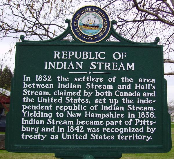
For a while, starting in 1832, Pittsburg was home to the Indian Stream Republic, a colony that established its own constitution and separate government. The Indian Stream Republic existed for over four years, then became a part of New Hampshire, and was incorporated with Pittsburg in 1840. The name Pittsburg is in honor of William Pitt, Prime Minister of England.