
Newberry Crater
Posted by:  Volcanoguy
N 43° 41.371 W 121° 15.271
10T E 640671 N 4838869
Newberry Crater is a 17 square mile caldera at the summit of Newberry Volcano which covers more than 600 square miles. The National Natural Landmark includes part of the summit area outside the caldera.
Waymark Code: WMAAK
Location: Oregon, United States
Date Posted: 04/12/2006
Views: 53
Newberry Crater is a 17 square mile caldera at the summit of Newberry Volcano. The Newberry Crater National Natural Landmark (Jan. 1976) is now part of the larger Newberry National Volcanic Monument (Nov. 1990) which is managed by the Deschutes National Forest.
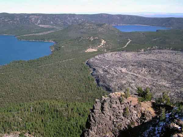
Newberry Crater from Paulina Peak.
Newberry Volcano is the largest Pleistocene volcano in Oregon covering an area of more than 600 square miles with a volume of more than 100 cubic miles. The volcano probably began forming about a 500,000 years ago and the first caldera formed about 300,000 years ago. Over the next 200,000 years the volcano continued to erupt, filled the caldera, and rebuilt a summit cone. About 80,000 years ago another series of large eruptions resulted in a second summit collapse which again formed a caldera. The caldera was about 1600 feet deeper than the present caldera and over the next 80,000 years, continuing eruptions have filled the caldera to its present depth. Over the last 12,000 years there have been 6 periods of eruptive activity in the caldera, with the last one ending only 1,300 years ago.
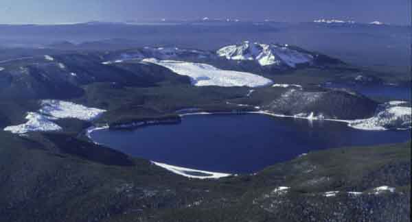
Aerial view of Newberry Crater.
The Parking/Access Location listed below is a small info station and gift shop at Paulina Lake near where County Road 41 enters the crater.