
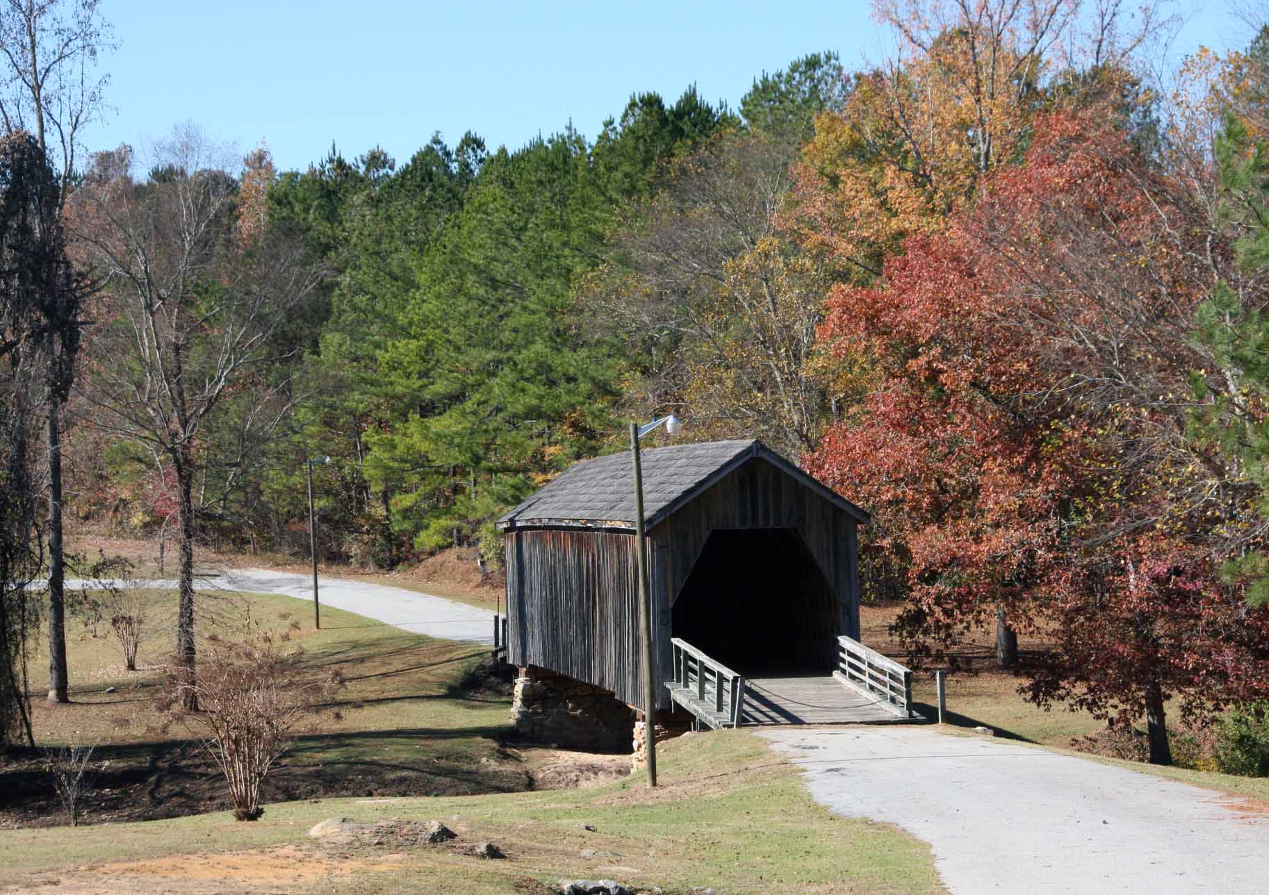
Auchumpkee Creek Covered Bridge - Upson Co., GA
Posted by:  Lat34North
N 32° 45.334 W 084° 13.812
16S E 759496 N 3627584
At the bridge on Allen Rd south of Thomaston, GA.
Waymark Code: WMA55T
Location: Georgia, United States
Date Posted: 11/18/2010
Views: 7
Auchumpkee Creek Covered Bridge
Auchumpkee Creek Covered Bridge
This bridge, 120 ft. long spanning 96 feet, was built in 1892 by the firm of Herring and Alford, using the town lattice construction. Its cost of $1,199 was funded by the Upson County Commission. It is the last remaining covered bridge in Upson County and was restored in 1985 by the Upson Preservation Commission. Dr. J.W. Herring was a noted bridge builder in this region until his death in 1911. Upson`s earliest settlers lived in this area in a small but thriving community known as Hootenville.
Type of Marker: Park

Marker #: None
Date: None
Sponsor: Unknown
|
Visit Instructions:
Take a picture of the marker, yourself at the marker, your gps at the marker, or anything specific to the text on the marker. And don't forget to enjoy your visit.