16-40 Williamson's Bridge
Posted by: Groundspeak Regular Member Mvillian
N 34° 16.209 W 079° 47.192
17S E 611708 N 3792776
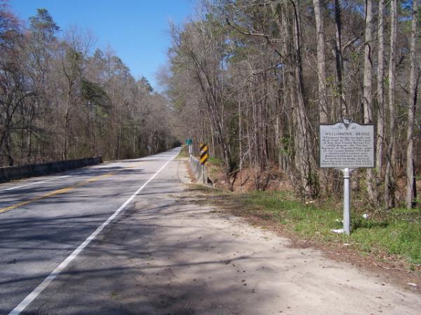
This marker is located on Charleston road a S.C. Scenic Byway, it is a beautiful area! erected by the Darlington County Historical Commission 2002
Waymark Code: WM9HX
Location: South Carolina, United States
Date Posted: 03/27/2006
Published By:Groundspeak Premium Member ChapterhouseInc
Views: 52

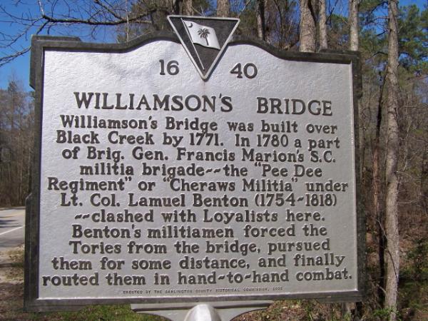
WILLIAMSON'S BRIDGE Williamson's bridge was built over Black Creek by 1771. In 1780 a part of Brig. Gen. Francis Marion's S.C. militia brigade~~ the "Pee Dee Regiment" or "Cheraws Militia" under Lt. Col. Lamuel Benton (1754~1818)~~clashed with Loyalists here. Benton's militiamen forced the Tories from the bridge, pursued them for some distance, and finally routed them in hand~to~hand combat.

Marker Name: WILLIAMSON'S BRIDGE

Marker Location: Roadside

Type of Marker: Battle (war)

Marker number: 16-40

County: Darlington

Visit Instructions:
A picture of the marker taken by you or specific details of the site.
Search for...
Geocaching.com Google Map
Google Maps
MapQuest
Bing Maps
Nearest Waymarks
Nearest South Carolina Historical Markers
Nearest Geocaches
Create a scavenger hunt using this waymark as the center point
Recent Visits/Logs:
Date Logged Log User Rating  
NCDaywalker visited 16-40 Williamson's Bridge 05/28/2018 NCDaywalker visited it
Harleyman1 visited 16-40 Williamson's Bridge 03/13/2011 Harleyman1 visited it
David Taylor visited 16-40 Williamson's Bridge 05/28/2009 David Taylor visited it
Team Hemisphere Dancer visited 16-40 Williamson's Bridge 02/22/2007 Team Hemisphere Dancer visited it

View all visits/logs