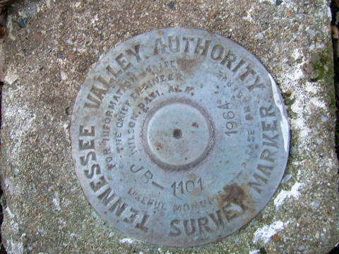
TVA Survey Disk JB-1101
Posted by:  Airmapper
N 36° 50.920 W 088° 01.961
16S E 407932 N 4078582
Tennessee Vally Authority Survey Marker inside the Land Between the Lakes Recreational Area.
Waymark Code: WM8T7
Location: Kentucky, United States
Date Posted: 03/11/2006
Views: 38
From Canton Kentucky go west on US 68-80 1.4 Miles to Road 153 on Right. On road 153 go 4.8 miles to road 146. Go approximately 1 mile on road 146. Road is unimproved and requires 4 wheel drive or hiking to reach mark. Mark is on the right of road 146, near a pull off. Mark is approximately 2 feet west of a steel witness post, with white signage.