
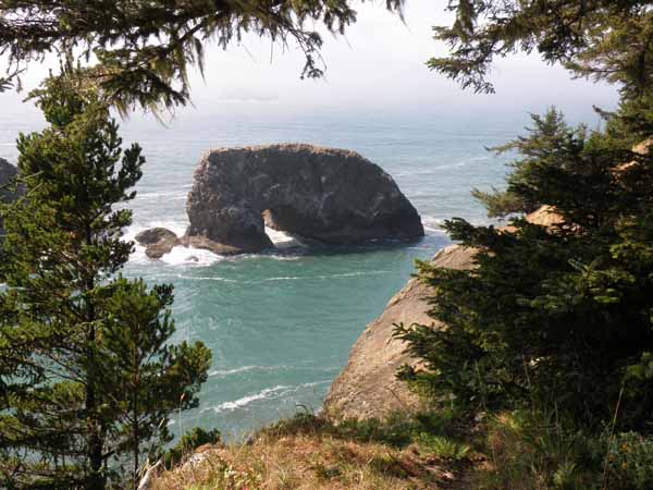
Arch Rock Viewpoint - Oregon
Posted by:  Volcanoguy
N 42° 12.303 W 124° 22.472
10T E 386529 N 4673457
Viewpoint off U.S. Hwy. 101 in Samuel H. Boardman State Park.
Waymark Code: WM7XPP
Location: Oregon, United States
Date Posted: 12/19/2009
Views: 22
This viewpoint provides views north and south along the coast and of Arch Rock. There is an interpretive sign about the formation of sea caves and arches.
Sign text: As you gaze out over this view, you are seeing econs of nature’s continuing work. The erosive power of wind and waves constantly sculpt these fantastic rocks, creating beautiful cliffs, islands and beaches.
The sediment carried in water constantly grinds against the rocks, slowly breaking them down. As waves crash, the cracks and crevices are weakened and they break apart.
Notches form and enlarge into sea caves, and eventually into arches. Sometimes, the top of an arch collapses, forming a natural blowhole.
The most dramatic erosion happens during fierce winter storms, when waves exert great force on the exposed rocks. Only the strongest parts of the rock resist. Arches collapse and form columns called sea stacks.