Calderon Trail - Cibola County, NM
Posted by: Groundspeak Regular Member linkys
N 34° 58.182 W 108° 00.189
12S E 773612 N 3873785
Trail within El Malpais National Monument that explores various volcanic features.
Waymark Code: WM7QTV
Location: New Mexico, United States
Date Posted: 11/24/2009
Published By:Groundspeak Regular Member condor1
Views: 10

NPS 2.6 mile trail with both printed trail guide and interpretive trail guides. Trail leads past a lava tube cave, lava sinks, a bat cave, lava trench and a cinder cone. Each is well explained in the trail guide.

Lava tube

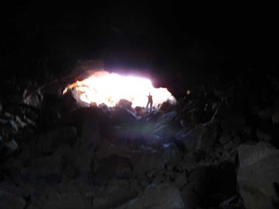
Cave Junction Lava Tube


Sink hole

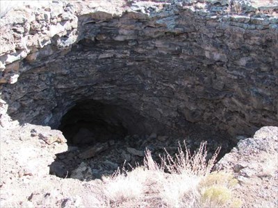
80 foot Deep Sink Hole


Cinder Cone

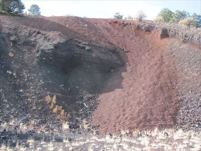
Cinder Cone Cross Section


Picture location 1: N 34° 58.146 W 108° 00.180

Picture Location 2: N 34° 57.978 W 108° 00.288

Picture Location 3: N 34° 57.540 W 108° 01.014

Visit Instructions:
To log a waymark you must post at least one original picture (preferably with yourself in it) showing the main feature or attraction of this walk/hike.
No picture means no proof which means No Post!
Search for...
Geocaching.com Google Map
Google Maps
MapQuest
Bing Maps
Nearest Waymarks
Nearest Scenic Hikes
Nearest Geocaches
Create a scavenger hunt using this waymark as the center point
Recent Visits/Logs:
Date Logged Log  
kingbee visited Calderon Trail - Cibola County, NM 08/19/2019 kingbee visited it
icaunais visited Calderon Trail - Cibola County, NM 04/08/2017 icaunais visited it
Benchmark Blasterz visited Calderon Trail - Cibola County, NM 07/29/2014 Benchmark Blasterz visited it

View all visits/logs