Kirkville, MT
Posted by:  linkys
N 46° 19.038 W 113° 17.215
12T E 323936 N 5131844
Kirkville, a mill town, was founded in 1888 and reached a peak population of about 125 people, primarily mill workers, before a precipitous decline in the early 1900's.
Waymark Code: WM7N5D
Location: Montana, United States
Date Posted: 11/11/2009
Views: 11
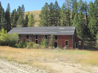
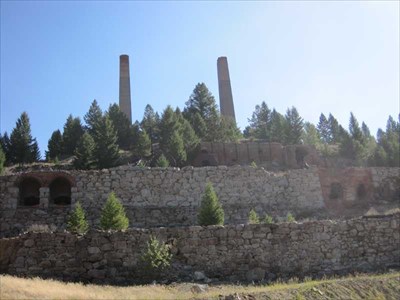
The location of a huge stamp mill that required over 500 employees to operate, Kirkville featured family homes, rooming houses, company buildings and many mine operations buildings. The main mill building was eight levels high, 150 feet wide and 450 feet long. At its height it was a thriving place.
Then the mines began to play out and Kirkville's fortunes changed. By 1908 its name had been changed to Clark and it was a mere shell of its former self.
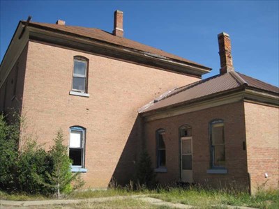
The mill remained until 1968 when it was burned as a safety hazzard, and today only a few mine buildings and the remains of the foundations of the homes and boarding houses remain.
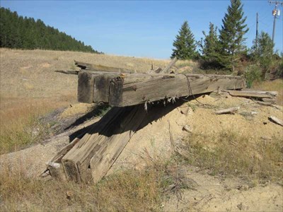
Today what remains is on private property, though it can still be visited by the lone ghost town visitor. It is fascinating to see the remains of the mill, the chimneys looming in the air, the several derilect buildings that still stand, and think of the glories of the past mining days in the big sky state.