Ancient Paths - Middlebury, VT
Posted by:  Telomere
N 44° 00.863 W 073° 10.156
18T E 646742 N 4875099
An ancient path, known as "The Indian Road", designated with a marker sign in the historic district of downtown Middlebury, VT.
Waymark Code: WM7J91
Location: Vermont, United States
Date Posted: 10/31/2009
Views: 15
Otter Creek is Vermont's longest river. An unusual feature is the northward direction of flow. At the center of Middlebury, it passes under a historic stone arch bridge, plunges over a curtain waterfall created by the slow erosion of the white marble riverbed, and enters a wide whirlpool, after passing under a pedestrian bridge of recent construction. This whirlpool has existed for centuries, and over time has scoured a giant pothole into this area.
The south side of this pothole is known locally as Frog Hollow. The north side, where this marker is located, is known as the Marble Works, referring to a district where quarried marble used to be transformed into finished products.
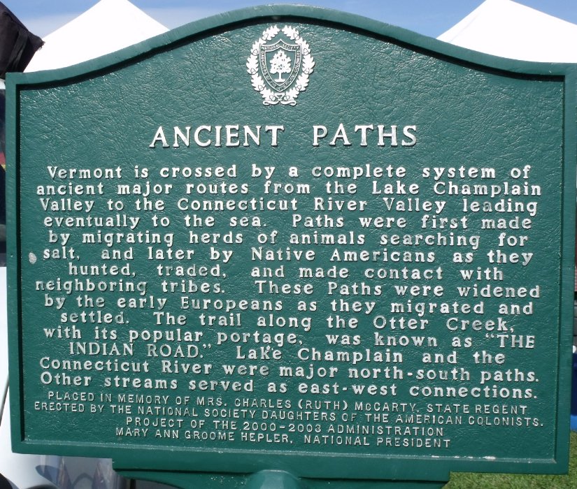
The marker is perched on the rim of the high riverbank, and reads:
ANCIENT PATHS
Vermont is crossed by a system of ancient major routes from the Lake Champlain Valley to the Connecticut River Valley leading eventually to the sea. Paths were first made by migrating herds of animals searching for salt, and later by native Americans as they hunted, traded, and made contact with neighboring tribes. These paths were widened by the early Europeans as they migrated and settled. The trail along the Otter Creek, with it's popular portage, was known as "THE INDIAN ROAD". Lake Champlain and the Connecticut River were major north-south paths. Other streams served as east-west connections.
The marker was placed by the National Society, Daughters of the American Colonists, in memory of Mrs. Charles (Ruth) McCarty, State Regent.