
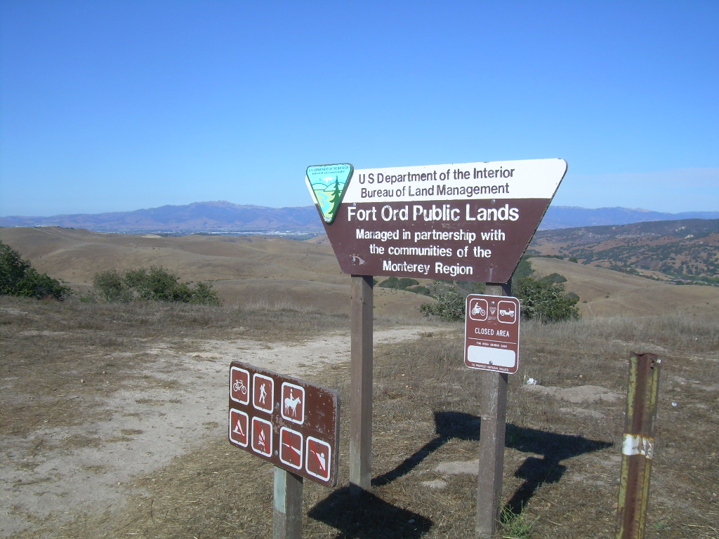
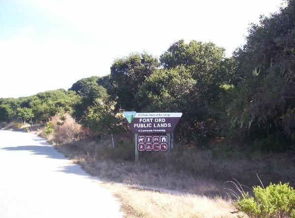
Fort Ord Public Lands: Laguna Seca Raceway Entrance
Posted by:  Touchstone
N 36° 34.719 W 121° 44.950
10S E 611907 N 4048860
One of six official entrances to the Fort Ord Public Lands which is managed by the Bureau of Land Management.
Waymark Code: WM6Y8V
Location: California, United States
Date Posted: 08/04/2009
Views: 2
Laguna Seca Raceway and Regional Park has one of several designated parking areas for the
Fort Ord Public Lands. There are numerous single track, dirt roads,
and a few paved roads that can be accessed from this location. Please note
that Laguna Seca is one of the higher points in the area, so most of the bike
trails from this point are pretty much downhill. The unfortunate
consequence of this is that you end up having to do some climbing to get back to
your car.
Fort Ord Public Land
The Fort Ord Public Land is administered by the BLM. The BLM has done
an outstanding job of developing the area for multiple uses. One of the
biggest draws to the area is the mountain biking. Every class of trail can
be encountered on the numerous trails in the old Fort Ord backcountry.
Private vehicles are banned, except by permit, from most of the roads administered
by the BLM, making for some excellent riding on asphalt. If you feel more adventurous,
there are plenty of well marked trails to choose from. Please stay on
marked trails only. There are numerous bandit trails and the BLM would
appreciate everyone's help in minimizing the impact in the area. Also,
please do not drive around any "Road Closed" barricades. The
coordinates for the various parking areas that I've submitted are where you
should park.
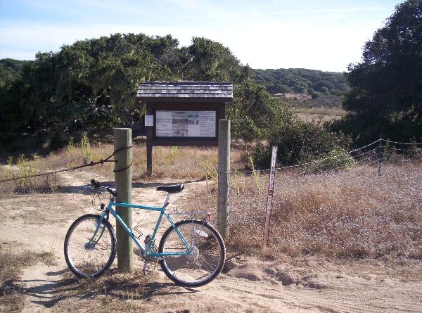
There are a few bulletin boards scattered throughout the area and one at the
Portola Road parking area that sporadically has the much coveted trail
maps. However, it's much easier to just download a map from boulter's
ExpertGPS calibrated maps. You don't need ExpertGPS
just to print the jpeg map out, but it may be worth you while to purchase it if
you intend to hunt for some caches in the area. It makes locating the
nearest trails much easier.