
Camp Cady (1860 - 1871)
Posted by:  BruceS
N 34° 56.703 W 116° 35.952
11S E 536598 N 3867022
Historic Army camp along the Mojave Road, an early trade route through the area.
Waymark Code: WM52HP
Location: California, United States
Date Posted: 10/31/2008
Views: 38
"
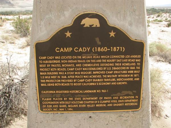
"Camp Cady was located on the Mojave Road which connected Los Angeles to
Albuquerque. Non-Indian travel on this and the nearby Salt Lake Road was beset
by Paiutes, Mohaves, and Chemehuevis defending their homeland. To protect both
roads, Camp Cady was established by U.S. Dragoons in 1860. The main building was
a stout mud redoubt. Improved camp structures were built 1/2 mile west in 1868.
After peace was achieved, the military withdrew in 1871. This protection
provided by Camp Cady enabled travelers, merchandise, and mail using both roads
to boost California's economy and growth." - text of marker