
Sandfly - GHS 25-17 - Chatham, Co., GA
Posted by:  Lat34North
N 31° 59.389 W 081° 04.556
17R E 492827 N 3539310
Sandfly historic marker located on Skidaway Rd., Montgomery Crossroad and Central Ave.
Waymark Code: WM4NDV
Location: Georgia, United States
Date Posted: 09/11/2008
Views: 13
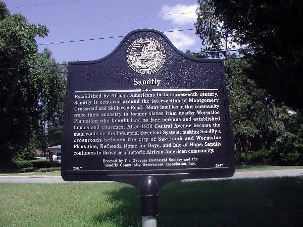 Sandfly
Established by African Americans in the nineteenth century, Sandfly is centered around the intersection of Mongomery Crossroad and Skidaway road. Many families in this community trace their ancestry to former slaves from nearby Wormsloe Plantation, bought land as free persons, and established homes and churches. After 1870 Central Avenue became the main route for the Industrial Streetcar System, making Sandfly a crossroads between the city of Savannah and Wormsloe Plantation, Bethesda Home for Boys, Isle of Hope, and Pinpoint. Sandfly continues to thrive as a historic African-American community.
Erected by the Georgia Historical Society and the
2003.7 Sandfly Community Betterment Association, Inc. 25-17