
McKay Crossing Falls, Oregon
Posted by:  Volcanoguy
N 43° 43.006 W 121° 22.734
10T E 630587 N 4841692
Falls on Paulina Creek just below McKay Crossing Campground.
Waymark Code: WM4MB
Location: Oregon, United States
Date Posted: 12/06/2005
Views: 69
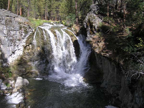
This 20-foot falls is located on Paulina Creek, just below Mckay Crossing Campground, at an elevation of about 4750 feet. There is no official name for this falls but it is commonly known as McKay Crossing Falls. It is also been referred to as Lower Paulina Creek Falls or Boilerpot Falls. No official trail or viewpoint but user trails lead to various views. For more information on McKay Crossing Falls visit the Waterfalls of the Pacific Northwest website.
Paulina Creek is undersized for the features found along the channel, it’s average annual discharge is 18 cubic feet per second. Between 2000 and 4000 years ago a small waterfall reached Paulina Lake and dropped the lake’s level by about 8 feet. This resulted in a flood with an estimated discharge rate of about 7000 cubic feet per second (almost 400 times the annual rate). The flood lasted no more than two days. This flood formed the many large scale features found along Paulina Creek. Here at McKay Crossing Falls during the flood there was a falls almost 100 feet wide.
Please include a picture at McKay Crossing Falls when you log this waymark.