
Lake Lenore Caves, Washington
Posted by:  Rose Red
N 47° 31.036 W 119° 29.613
11T E 312268 N 5265662
The Lake Lenore Caves were formed during the last Ice Age, when the catastrophic Missoula Ice Age Floods raged across much of eastern Washington State.
Waymark Code: WM4DXM
Location: Washington, United States
Date Posted: 08/10/2008
Views: 96
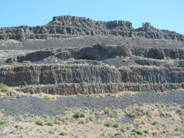
The Lake Lenore Caves were formed during the last Ice Age, when the catastrophic Missoula Ice Age Floods raged across much of eastern Washington State. These floods carved long, deep ravines (coulees) from solid basalt. The effect of water freezing and thawing within the basalt enlarged the caves over thousands of years.