|
 Tragedy Spring, California
N 38° 38.364 W 120° 08.817
10S E 748322 N 4280623
Tragedy Spring
Waymark Code: WM3VJC
Location: California, United States
Date Posted: 05/21/2008
Views: 62
 Click on any picture for larger images and click the blue links for other nearby waymarks.
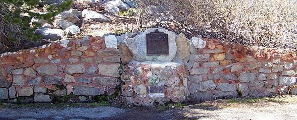 Tragedy Spring Monument
This spring is located along an old emigrants trail. In the 1840s and 50s, it was a traditional resting place for California Settlers. It was named for an incident on June 27, 1848, when three scouts were murdered here by unknown people. The three men were former members of the Captain Davis's Company A of the Mormon Battalion. They were the first people to open a wagon road over the southern route from California to Utah in 1848. Their comrades carved their names in a tree nearby at the trail. That part of the tree is now preserved in Fort Sutter in Sacramento. The State of California declared the location a Historic Landmark and erected a Historic Marker at the location of the tree. In addition, the Daughters of Utah Pioneers built a monument in honor of the three scouts right next to the spring.
|
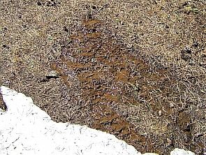 The original Spring
 |
 The spring is right next to the monument
|
One of the members of the wagon train, noted the following in his diary:
|
"We cut the following inscription in the Balsam Fir that stood near the grave. To the memory of Daniel Browett, Ezrah H. Allen, and Henderson Cox, who were supposed to have been murdered and buried by Indians on the night of June 27, A.D., 1848. We call the place Tragedy Spring." |
|
Read more about it at Traveling the Mormon Trail.
|
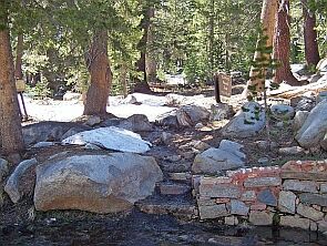
USDA El Dorado National Forest and the Sacramento Chapter of Daughters of Utah Pioneers joined forces and built a picnic area at the spring. Unfortunately, it was too early in the year for a picnic.
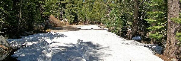
In the summer, one can drive all the way to the monument.
We were there in mid May and, considering the road conditions, chose to hike instead.
|
It turned out we weren't really prepared for a hike.
Public or Private Land?: Public

Public Land Fees?: no
Private Land access?: Not listed
|
Visit Instructions:
Please post an original picture of the springs no GPS necessary along with your observations of the spring. What wildlife you saw if any and the condition of the springs. Water level was high, low. The area was clean, trashy ect. Any other knowledge or experiences you have had with this paticular spring that would help document it's history.
Recent Visits/Logs:
| There are no logs for this waymark yet. |
|
|
|
|