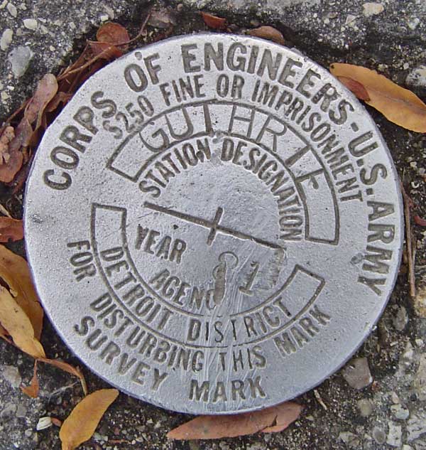
US Army BM - Guthrie
Posted by:  Hard Oiler
N 42° 54.047 W 082° 27.468
17T E 380985 N 4750827
A well preserved BM placed in 1981 by the US Army Corps of Engineers on the Canadian side of the St Clair River south of Sarnia, Ontario
Waymark Code: WM3QX
Location: Ontario, Canada
Date Posted: 11/14/2005
Views: 44
A well preserved BM in the middle of a new hiking/biking trail that .runs along the banks of the St Clair River. Obviously the passing joggers keep it well polished
Not listed in the CSRS database and somewhat curious to find a US mark here particularly as there is a Canadian benchmark, also established in 1981, located close by. Maybe we didn’t trust each others data as there are also Canadian placed BM’s located on the US side of the border in this area./p>