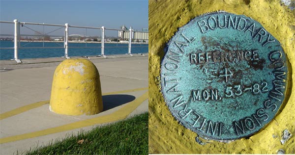
International Boundary Commission Marker: 53-82
Posted by:  Hard Oiler
N 42° 58.538 W 082° 24.514
17T E 385143 N 4759071
An IBC marker close to the waterfront in Sarnia
Waymark Code: WM3QT
Location: Ontario, Canada
Date Posted: 11/14/2005
Views: 106
Although a number of the International Boundary Commission markers, used originally to define the border with the US, are listed in the CSRS database, this one strangely isn’t. It’s very prominent on the walking/biking path along the waterfront and painted yellow to avoid collisions, unlike similar monuments in the area that are painted white. The border here runs down the St Clair river and land-based benchmarks, such as this, were used to establish the virtual turning points in the river where the border changes direction.
This is a good spot to start a geocache hunt – there are currently about 10 caches within ½ mile of this waymark.