The Crash of the Flying Sioux
Posted by: Groundspeak Charter Member NevaP
N 44° 00.535 W 097° 47.505
14T E 596856 N 4873572
This double sided marker tells of the tragic collision of two B-17 bombers during a training flight in 1943.
Waymark Code: WM3QH3
Location: South Dakota, United States
Date Posted: 05/05/2008
Published By:Groundspeak Premium Member MNSearchers
Views: 43

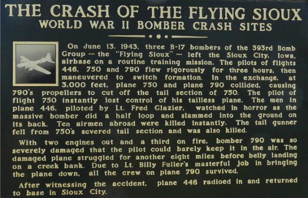
The marker is located close to another historical marker at Fedora, on Rt.34, in Miner County. The west side tells how the planes collided and related what happened then.

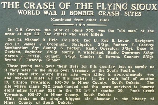
The east side of the marker lists the names of the eleven airmen who died in the accident and gives the locations in Miner county where one plane crashed and the other made a crash landing.

Marker Name: The Crash of the Flying Sioux

Marker Type: Roadside

Marker Text: Not listed

Visit Instructions:
A photo of the 'Marker' or 'Plaque' is required to identify the location, plus a picture of the 'Historic Site'. If you do not post a photo your log will be deleted.
Search for...
Geocaching.com Google Map
Google Maps
MapQuest
Bing Maps
Nearest Waymarks
Nearest South Dakota Historical Markers
Nearest Geocaches
Create a scavenger hunt using this waymark as the center point
Recent Visits/Logs:
Date Logged Log User Rating  
DakotaBuffalo visited The Crash of the Flying Sioux 05/03/2012 DakotaBuffalo visited it
dbrockhouse visited The Crash of the Flying Sioux 10/16/2011 dbrockhouse visited it
NGComets visited The Crash of the Flying Sioux 04/29/2009 NGComets visited it

View all visits/logs