
Harlan D. Miller Memorial Bridge
Posted by:  TheBeanTeam
N 40° 56.252 W 122° 25.145
10T E 548902 N 4531985
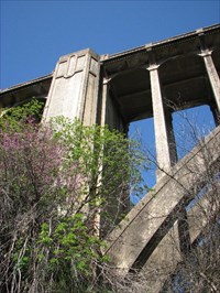
The Harlan D. Miller Memorial Bridge, also known as the Dog Creek Bridge, was built in 1927. This abandoned bridge is located where Dog Creek enters the Sacramento River.
Coordinates were taken at a benchmark that has been stolen from the bridge.
Waymark Code: WM3PVY
Location: California, United States
Date Posted: 05/01/2008
Views: 36
This bridge is named after the man who designed it. It is located at the confluence of Dog Creek and the Sacramento River this bridge is an unused and abandoned remnant of old Highway 99. View of bridge in 1927 during construction
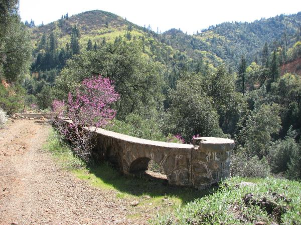
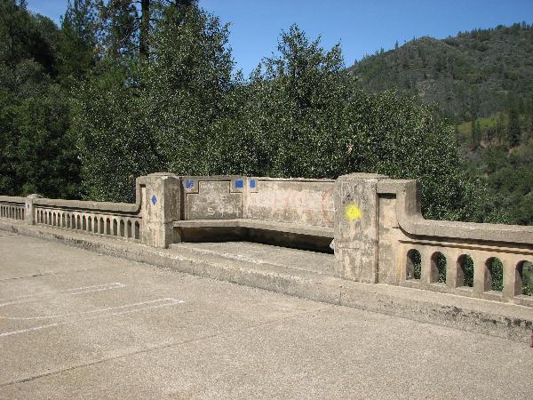
This stunning reinforced concrete arch bridge is viewable both from beneath and on top.
Directions to view the bridge from below in your vehicle
To view the bridge from below in your vehicle take the Volmers / Delta exit.
If going Northbound, go under the freeway (on Dog Creek Road) then turn left on Fender Ferry Road. Drive approx. 2 miles on a dirt road to see the bridge.
If going Southbound, turn right at the end of the offramp(on Dog Creek Road) then turn left on Fender Ferry Road. Drive approx. 2 miles on a dirt road to see the bridge.
__________________________________________________
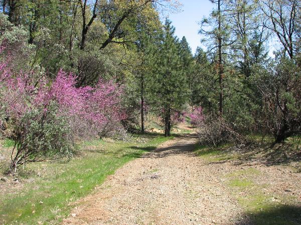
The hike to the bridge is a bit more complicated but worthwhile. Along the short hike (less than a mile out and back) you will find other examples of old Highway 99 in the form of clumps of asphalt and stone guard rails. The views are splendid.
Directions to hike on a section of abandoned Highway 99 to the bridge
Take the Vollmers / Delta exit:
If going Northbound, turn right at the end of the off ramp.
If going Southbound, go under the freeway and proceed to the area where the Northbound offramp ends. Continue straight past the Northbound offramp.
There are several private road and no trespassing signs. The old roadway to the bridge is public property but be careful not to stray into these private areas. Park near where the paved roadway ends and head down the single track dirt road that was once Highway 99. The roadway is blocked with boulders just after the corner so if you pull in to far you will have a long ways to back out.