|
 Fort Brown - Brownsville, Texas Posted by:  JimmyEv JimmyEv
N 25° 53.891 W 097° 29.625
14R E 650882 N 2865274
Fort Brown was instrumental in precipitating the Mexican War. The fort also played a role in the Civil War, the Spanish-American War, and protected Brownsville from bandit raids at the turn-of-the century.
Waymark Code: WM3B8X
Location: Texas, United States
Date Posted: 03/08/2008
Views: 133
|
President James K. Polk had dreams of manifest destiny - the American empire stretching across the continent from the sea to shining sea. Quiet negotiations had been carried out with the Mexican government, seeking to purchase California, Nevada, Arizona and New Mexico from Mexico. The Mexican government rejected these political advances outright after the American annexation of the Republic of Texas.
At the end of the Texas Revolution, the area of Texas between the Nueces River and the Rio Grande River was claimed by both Mexico and the Republic of Texas. Most documents indicated that the border of Texas was defined as the Nueces; proof that the Rio Grande was the border was as tenuous as the earlier supposition that the border between the United States and Mexico was actually the Neches River, and not the Sabine. |
 |
|
Unable to get political support in America for a military seizure of Mexican lands, President Polk set about to provoke the Mexicans. In 1848, Polk sent General Zachary Taylor to Texas, with orders to establish a fort at the southernmost part of the disputed territory between the Nueces and Rio Grande Rivers. On March 28, 1846, Taylor established Fort Texas on the flat, chaparral-covered prairie along the banks of the Rio Grande, in a bend where the river dipped deep into the Mexican city of Matamoros. Earthen fortifications were built directly on the river’s banks. |
 |
After establishing the fort, General Taylor left a garrison of fifty men, commanded by Major Jacob Brown, while he marched his troops back to the supply depot of Fort Polk in Point Isabel. Mexican Generals Arista and Ampudia crossed the Rio Grande (Rio Bravo), intent on taking Fort Texas and capturing Taylor. A large force with seven cannon laid siege to Fort Texas; the majority of the Mexican forces pursued Taylor along the Point Isabel Road.
Taylor turned back upon learning of the attack on Fort Texas. Taylor’s forces and the Mexican forces first clashed at Palo Alto. The Mexicans were driven back to Resaca de Guerrero (now Resaca de la Palma). The following day, Taylor attacked the Mexicans at Resaca de Guerrero and drove all the Mexican forces across the river. Fort Texas held out during the siege, but Major Brown had been killed. The fort was promptly renamed for Major Brown.
|
|
Mexico had 'attacked Americans on American soil,' and the effect was what President Polk had anticipated. Support for the Mexican War coalesced, Mexico was invaded, and the territories of California, Nevada, Arizona, and New Mexico were added to the American empire, finally stretching from sea to shining sea.
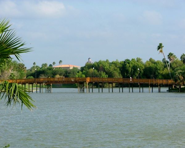
Fort Brown eventually encompassed 358 acres surrounded by the city of Brownsville, which had developed around the fort. In the middle of the fort was a 25½-acre resaca. The original fort had infantry located on the northern boundary, where a wall separated the fort from the city of Brownsville. Artillery was located midway between the northern and southern borders of the fort.
At the beginning of the Civil War, Federal troops evacuated, turning the fort over to Texas State troops. In November of 1863, the Union army seized control of Fort Brown until the following July, when they were driven out by Confederate forces. The Union forces settled in at Brazos Santiago, along the coast, and remained there until Lee's surrender. The last land battle of the Civil War, fought a month after the surrender of the Confederacy, occurred at Palmito Hill, between Confederate forces stationed at Fort Brown and the Union forces stationed at Brazos Santiago.
|
|
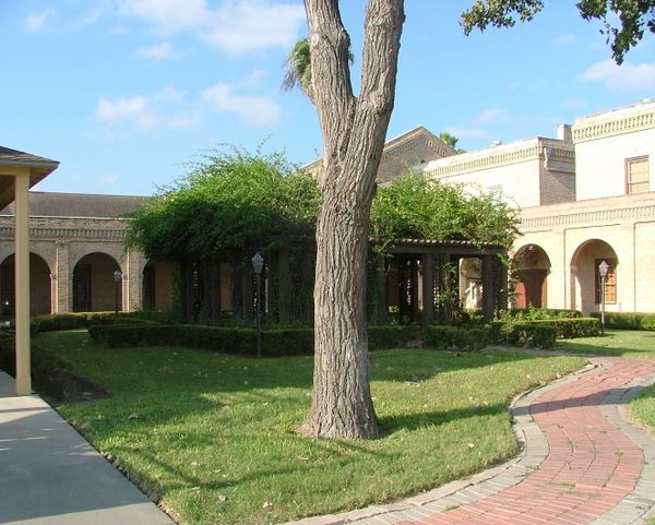
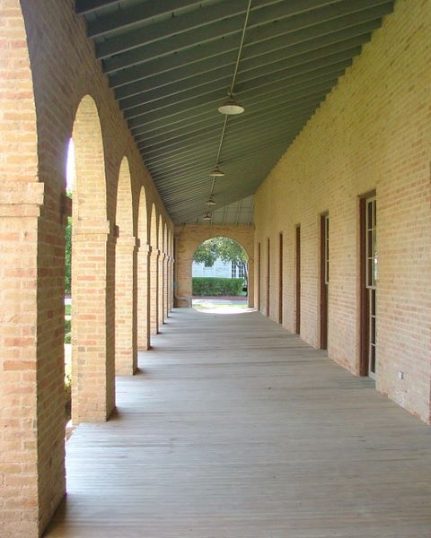
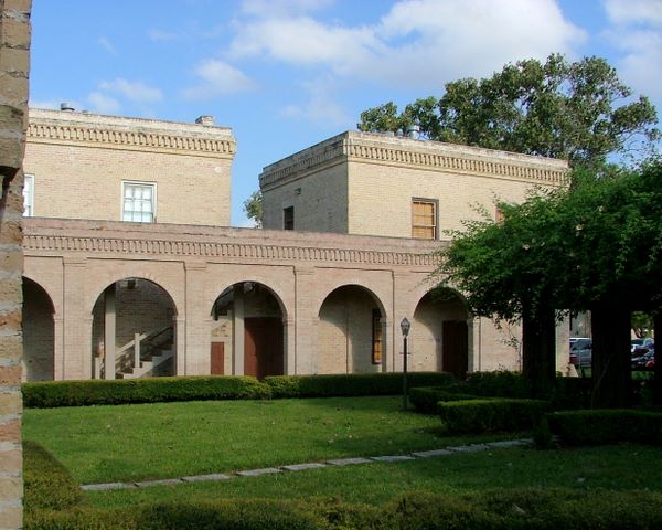
In 1869, officers’ quarters, the post hospital, a headquarters building and the chapel were built. In 1882 Lt. William Crawford Gorgas began his yellow fever experiments at the fort’s Post Hospital. After the Spanish-American War, Gorgas rid Havanna of yellow fever.
In a story that seems to have been played out in southern military post after southern military post, a black regiment, in this case the 25th, was stationed at the fort, much to the chagrin of the locals. On August 13, 1906, local citizens accused members of the regiment of killing a white bartender. No one could identify the alleged shooter because ‘they all look alike.’ The military asked the killer to step forward. When no one stepped forward, President Theodore Roosevelt dishonorably discharged all of the 167 black soldiers in the regiment for a ‘conspiracy of silence.’ Fort Brown was transferred from the War Department to the Department of the Interior, and used to breed spineless cacti until 1914.
Border tensions and raids by bandits caused the fort to be reactivated in 1914. The first American plane shot at by a foreign force, in this case Pancho Villa, took off from Fort Brown. The fort was not decommissioned until the end of World War II in 1944. The land was given to Texas Southmost College.
Not much of the original fort remains. A national cemetery was once located on the island in the resaca; the cemetery is gone. Most of the remaining original structures are limited to the area around the Post Hospital (this is where the coordinates will put you), including its annex, a handful of officers’ quarters, the morgue, the commissary/guard house, and the cavalry building. With the old buildings inter-connected by wooden boardwalks and surrounded by lush landscaping, it’s a very pleasant area of campus to stroll around. Unfortunately, the Border Wall is designed to cut through the middle of the campus.
The old breastworks of the fort are now grass covered mounds, located in the northern corner adjacent to the golf course. Here you can find an upended cannon that allegedly marks the spot where Major Brown died. Also near-by is a marker with a table indicating the location and dimensions of the original fort - earthworks with an 800-yard perimeter, 9½ feet high, six bastions, a 15-foot wide parapet wall, and a surrounding ditch, 8½-feet deep and 20 feet wide.
|
|
Street address:
South edge of Brownsville off of International Drive
Brownsville, TX USA

County / Borough / Parish: Cameron County
Year listed: 1966
Historic (Areas of) Significance: Event
Periods of significance: 1825-1849, 1850-1874, 1875-1899, 1900-1924
Historic function: Fort
Current function: University
Primary Web Site: [Web Link]
Secondary Website 1: [Web Link]
Privately owned?: Not Listed
Season start / Season finish: Not listed
Hours of operation: Not listed
Secondary Website 2: Not listed
National Historic Landmark Link: Not listed
|
Visit Instructions:
Please give the date and brief account of your visit. Include any additional observations or information that you may have, particularly about the current condition of the site. Additional photos are highly encouraged, but not mandatory.
|