|
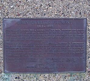
This plaque marks the place where John C. Fremont camped during the Standoff at Gavilan Peak in 1846. The inscription reads:
|
|
John Charles Fremont was a naturalist, explorer, scientist and captain with the U.S. Topographic Engineers on his third expedition to the West when he camped on this mountain. His assignment was to survey, map, chart trails and find the shortest route between the East and the West for the U.S. Government.
Besides his military activities in California, Fremont is remembered for giving San Francisco's "Golden Gate" its name; he was the military governor of California for 50 days; he was the first U.S. Senator to be
|
|
|
elected from California; he won the Republican nomination for the presidency and he was a Major General in the Civil War and was territorial governor of Arizona.
Fremont's friends called him "The West's Greatest Adventurer," "A Man Unafraid," The Pathfinder," and "The Pathmaker of the West."
August 12, 1989
Monterey Viejo Chapter 1846
E Campus Vitus
|

 |
Here is what the Standoff at Gavilan Peak was all about:
This is a battle that didn't happen because of strong wind and a somewhat superstitious commander. Had there only a single shot been fired, California's history might have turned out totally different. |
|
|
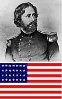
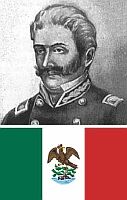
In 1846, while California was still a part of Mexico, US Army Captain John C. Fremont of the Topographic Engineers led an expeditionary force of 60 men into the Salinas Valley and to the top of Gavilan Peak. Ostensibly, Fremont and his group were to explore and survey the area. Ostensibly, Fremont and his group were there to explore and survey the area. However, the group's makeup was clearly and armed force. The peak was a strategic location - from his encampment, Fremont could see anyone approaching for miles. Long suspicious of Fremont's motives, Mexican Commandante General Jose Castro ordered him to leave California immediately. In defiance, Fremont quickly built a log stockade at the peak and raised a U.S. military flag.
For three days Fremont looked down on San Juan Bautista and Castro's growing force. For that same length of time the Mexican leaders looked up at an American flag that Fremont's men had raised atop Gavilan Peak. On the evening of March 9 the flag pole fell down. Fremont decided to treat this as an omen and that night left the mountain top and eventually worked his way slowly north through the Sacramento Valley to Oregon. Castro declared to the Mexican Minister of War that he had won the day, but made no effort to follow the Americans.
This text was taken partially from the Park Brochure of Fremont Peak State Park and partially from Inn-California's article The Gavilan Peak Incident.
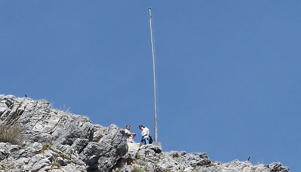
The historic flagpole at Fremont Peak
Everywhere in the park and even in the State Park brochure one can read that the Gavilan Incident was the first time for the US Flag to fly over California. I don't mean to sound too smart, but that is wrong on at least two levels:
|
 |
1. The American flag was first raised on California soil on October 20, 1842 in Monterey during one of history's biggest misunderstandings.
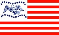
2. Fremont's flag was not an official US Flag to start with.
|
|
During the 1840's it was not yet common for the U.S. Army to carry the official flag. Each was known to have their own regiment banner or garrison flag. Fremont's flag was designed and made by his wife for use during his explorations of the far western parts of the continental United States. Between the rows of the 26 stars in the canton of his flag was an eagle. The eagle held the usual arrows of war, but the olive branch of peace was replaced by the calumet, or peace pipe. He hoped that this would be accepted by the Indians he met in his travels as a token of his peaceful intentions. The flag can still be seen at the Southwest Museum in Los Angeles.
|
Fremont Peak is a registered California Historic Landmark, but strangely enough, the
California Historic Marker for the place is located 11 miles away in San Juan Bautista.
Well, at least E Clampus Vitus got the location right.
|