
Federal Right Wing to Peachtree Creek - GHM 060-26A - Fulton Co., GA
Posted by:  Lat34North
N 33° 50.960 W 084° 25.983
16S E 737500 N 3748415
Federal Right Wing to Peachtree Creek State Historical Marker located on the west side of Paces Place at the intersection of West Paces Ferry Rd and Paces Place, just west of I-75, Atlanta, GA.
Waymark Code: WM2JFZ
Location: Georgia, United States
Date Posted: 11/11/2007
Views: 27
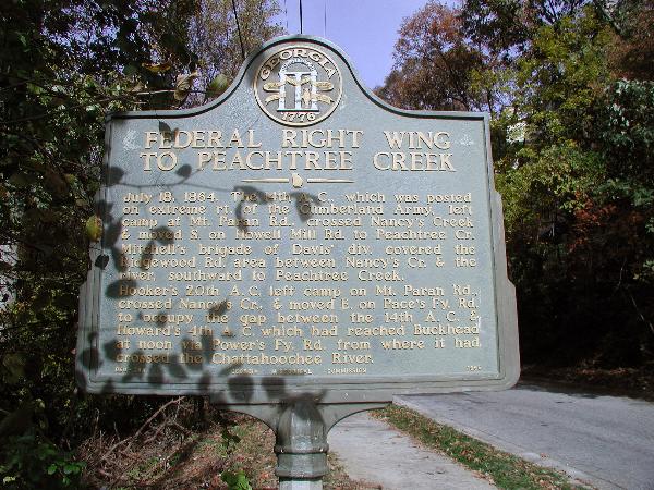 FEDERAL RIGHT WING TO PEACHTREE CREEK
July 18, 1864. The 14th A.C., which was posted on extreme rt. of the Cumberland Army, left camp at Mt. Paren Rd., crossed Nancy’s Creek & moved S. on Howell Mill Rd. to Peachtree Cr. Mitchell's brigade of Davis' Div. covered the Ridgewood Rd. area between Nancy's Cr. & the River, southward to Peachtree Creek.
Hooker's 20th A.C. left camp on Mt. Paren Rd., crossed Nancy’s Cr., & moved E. on Pace’s Ferry Rd. to occupy the gap between the 14th A.C. & Howard's 4th A.C. which had reached Buckhead at noon via Power’s Ferry Rd. from where it had crossed the Chattahoochee River.
GHM 060-26A - Georgia Historical Commission - 1956
Note: In Feb. 2011, the marker was reported as being missing.