
Old Montgomery Ferry Rd. – GHM 060-84 – Fulton, Co., GA.
Posted by:  Lat34North
N 33° 48.329 W 084° 23.753
16S E 741063 N 3743637
Old Montgomery Ferry Rd. State Historical Marker located at 28th St. and Wycliff Rd., Atlanta, Ga.
Waymark Code: WM2HEZ
Location: Georgia, United States
Date Posted: 11/05/2007
Views: 28
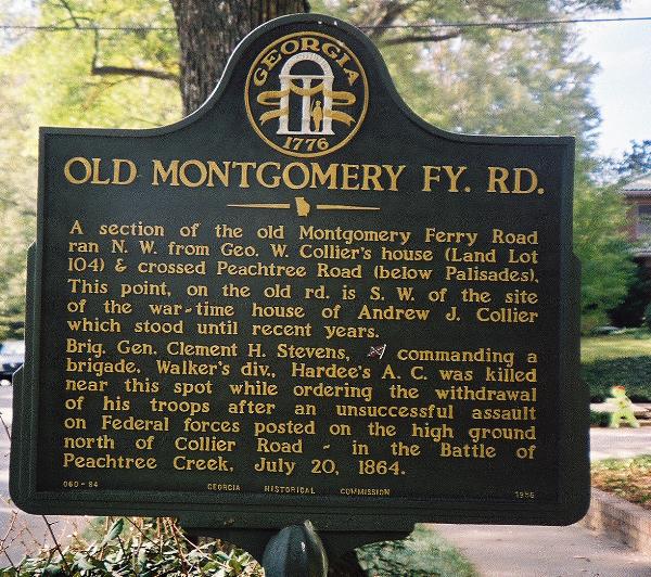 OLD MONTGOMERY FY. RD
A section of the old Montgomery Ferry Road ran N.W. from Geo. W. Collier's house (Land Lot 104) & crossed Peachtree Road (below Palisades). This point, on the old rd. is S.W. of the site of the war-time house of Andrew J. Collier which stood until recent years.
Brig. Gen. Clement H. Stevens, [Confederate] commanding a brigade, Walker's div., Hardee's A.C. was killed near this spot while ordering the withdrawal of his troops after an unsuccessful assault on Federal forces posted on the high ground north of Collier Road -- in the Battle of Peachtree Creek, July 20, 1864.
GHM 060-84 - Georgia Historical Commission - 1956