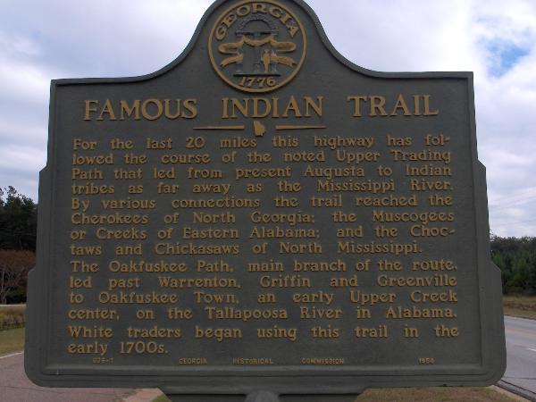
Famous Indian Trail (Columbia County)
N 33° 24.800 W 082° 18.318
17S E 378631 N 3697871
Notes the nearby Upper Trading Path network linking Native American tribes of the southeast.
Waymark Code: WM28Q
Location: Georgia, United States
Date Posted: 10/07/2005
Views: 109
For the last 20 miles this highway has followed the course of the noted Upper Trading Path that led from present Augusta to Indian Tribes as far away as the Mississippi River. By various connections the trail reached the Cherokees of North Georgia; the Muscogees or Creeks of Eastern Alabama; and the Choctaws and Chickasaws of North Mississippi.
The Oakfuskee Path, main branch of the route, led past Warrenton, Griffin, and Greenville to Oakfuse Town, an early Upper Creek center, on the Tallapoosa River in Alabama. White traders began using this trail in the early 1700s.