
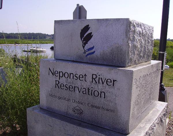
Neponset River Reservation - Boston, MA
Posted by:  silverquill
N 42° 16.572 W 071° 03.230
19T E 330640 N 4682485
The Neponset River forms Boston's southern border with Quincy and Milton. Despite its history as an industrial center,many scenic vistas remain. Partially built on the old Granite Railway Corporation line. Open dawn to dusk.
Waymark Code: WM1GQC
Location: Massachusetts, United States
Date Posted: 05/06/2007
Views: 150
Open year round dawn to dusk. The Neponset River, unlike the Charles and Mystic Rivers, remains a natural estuary with extensive marshlands at its mouth and significant freshwater wetlands along much of its upstream length. It provides an unusually rich and diverse habitat for both plants and animals including a number of threatened and endangered species. The estuarine portion of the Neponset River upstream of Granite Avenue is characterized by extensive tidal marshes. Granite bound for Boston from Quincy was transferred by early railroad to boats at a pier on the Milton Shore. This segment of the river offers interesting canoeing and nature study opportunities.
In the late 1880's, inspired by the founders of the Metropolitan Park System, Charles Eliot and Sylvester Baxter, the Metropolitan Park Commission acquired the Neponset River salt marshes - the first salt marshes in the Commonwealth to be publicly owned.
Over the past 100 years the Metropolitan District Commission (MDC) has actively worked to acquire approximately 750 acres along the Neponset River. These acquisitions include formerly used lands, such as the Neponset Drive-In and Hallett Street land fill in 1973 and Shaffer Paper the former Sterns Lumber Yard, in 1986, all to be rehabilitated as parkland and an abandoned rail right of way in 1990.
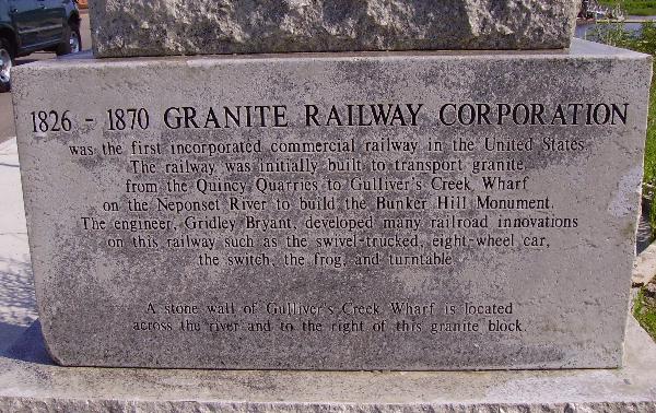
Portions opened in 2002, this section offers hiking and biking along the old rail bed of the old Granite Railway Corporation line dating from 1826 - 1870, built as the first incorporated commercial railway in the United Stats, used initially to transport granite from the Quincy Quarries to Gulliver's Creek Wharf on the Neponset River to build the Bunker Hill Monument.
Coordinates and phots taken at the Granite Street entrance.