
Crossing the Great Divide - Lucerne, British Columbia
Posted by:  T0SHEA
N 52° 52.930 W 118° 27.076
11U E 402342 N 5860149
The Crossing the Great Divide sign of history is on Hwy. 16/Yellowhead Hwy. in the Portal Lake Rest Area. It is about 200 meters west of the British Columbia and Alberta border.
Waymark Code: WM1196N
Location: British Columbia, Canada
Date Posted: 09/10/2019
Views: 1
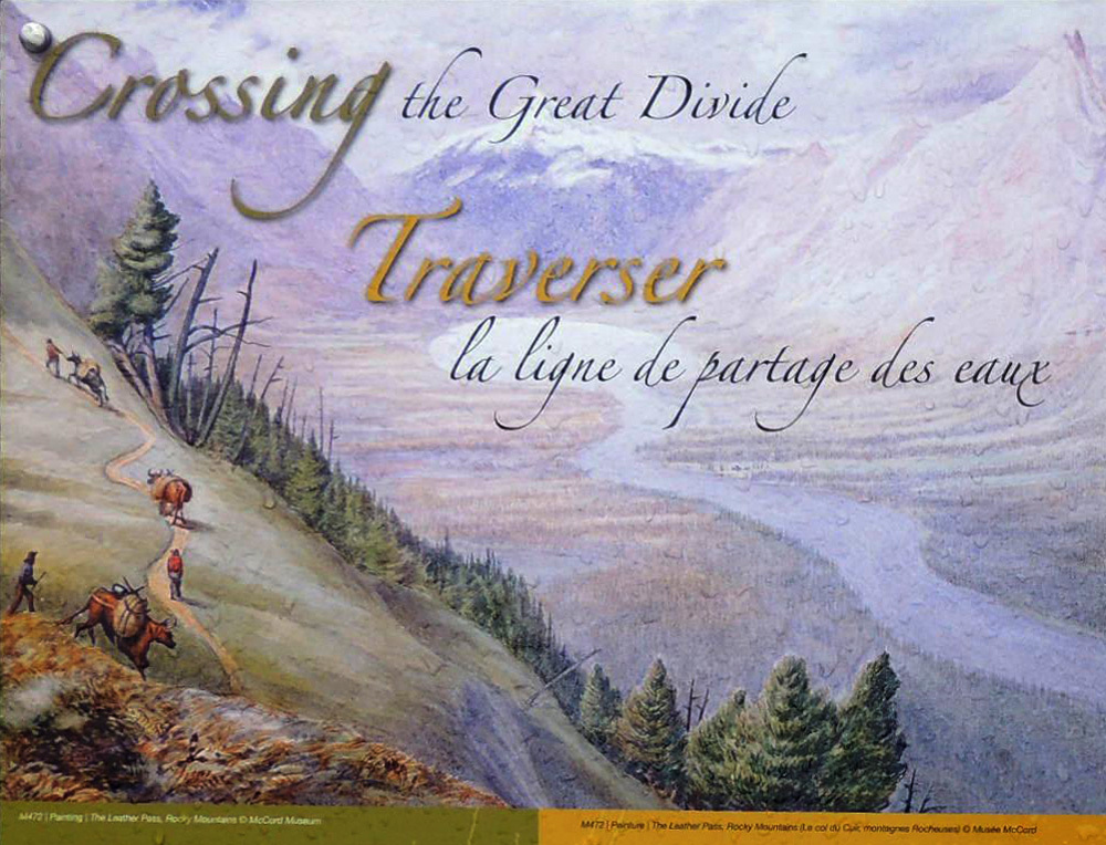 Crossing the Great Divide
Yellowhead Pass National Historic Site straddles the Alberts British Columba border, stretching from the outskirts of the town of Jasper to the Fraser River crossing Mount Robson Provincial Park. One of the lowest elevation routes across the Great Divide the northern Rockies (1,133 m; 3,317 ft.) the Pass is surrounded by steep, heavily forested mountains.
Aboriginal and non-Aboriginal traders, including the French-Canadian Voyageurs, carried goods of various kinds back and forth across the pass, just like trucks, trains and the pipeline do today. For a brief period in the mid-1800s, the pass was known as “Leather Pass” because of the flow of leather going to New Caledonia.
The Hudson’s Bay Company started using the pass around 1825 to keep information flowing between its administrative headquarters and the trading district of New Caledonia and the upper Fraser River. Yellohead Pass was abandoned as a route by the fur trade in 1855.
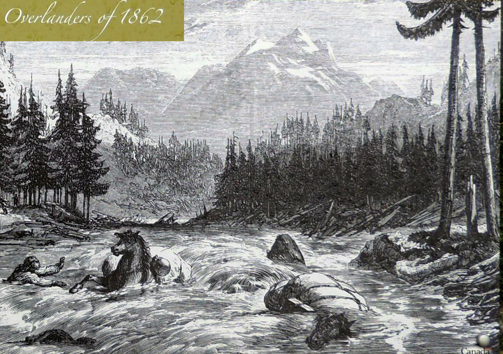
Overlanders of 1862
Searching for a better life, 115 man and one woman left their Ontario homes to strike it rich in British Columbia’s gold fields. Crossing the mountains in 1862, the group endured hardship through trackless forests as well as starvation and hypothermia.
Some even drowned in the turbulent waters of the Fraser and North Thompson rivers. In the end, most survived, but few became rich. Their difficulties made their journey one of the most impressive events in Canadian travel history.