The 422 foot high, 3055 foot long concrete gravity dam was built and is operated by the United States Army Corps of Engineers. The five generators in the powerhouse are capable of generating 600 Megawatts of electricity.
Accompanying the dam is a visitor centre providing historical displays and information about the dam, wildlife, and recreation associated with the dam and reservoir. The centre has a newly remodeled exhibit area, books and gifts sales area and an auditorium featuring a video entitled "
The Power and Beauty of the Kootenai, the Story of Libby Dam".
As one enters the visitor centre they pass a bulletin board and an electronic data display which contains six distinct operating parameters associated with Libby Dam and Lake Koocanusa. From top to bottom on the display they are:
- Current Pool Elevation
- Feet Down from Full Pool
- Inflow to Lake
- Discharge from Dam
- Generators Running
- Current Temperature
|
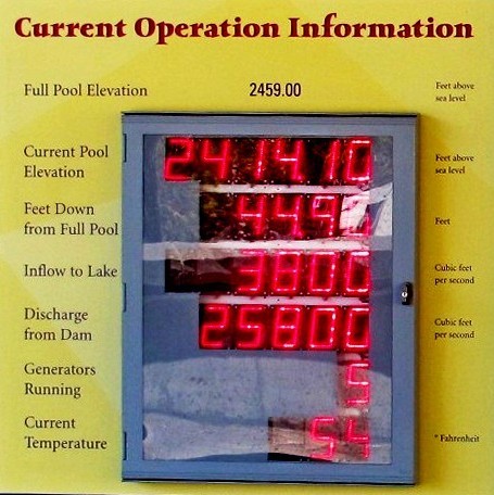 |
To the right of each datum the units in use are shown, such as cubic feet per second, feet, degrees fahrenheit, etc. Some of this data, in particular inflow and outflow rates and pool height, are
published online. The first two are ones which the typical tourist may take notice of as, when viewing Lake Koocanusa from the dam, the high water line around its banks is quite noticeable and observers will easily be able to see how far down from full pool the lake is on a given day.
LIBBY DAM
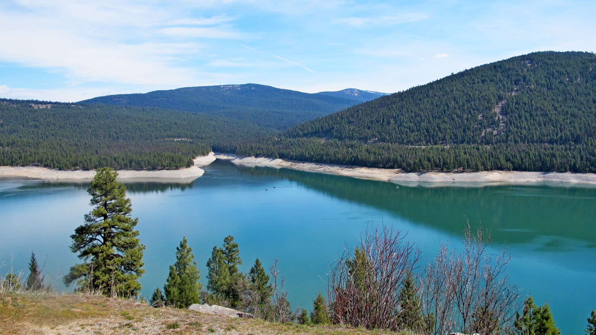
Dedicated on August 24, 1975, Libby Dam spans the Kootenai River 17 miles (27 km) upstream from the town of Libby, Montana. Libby Dam is 422 feet (129 m) tall and 3,055 feet (931 m) long. The reservoir behind the dam is Lake Koocanusa; it extends 90 miles (140 km) upriver from the dam and has a maximum depth of about 370 feet (110 m) . Forty-two miles (68 km) of Lake Koocanusa are in British Columbia, Canada. Lake Koocanusa was named for the treaty that was developed between the Kootenai Indians, the Canadian government, and the U.S. government to build the Dam and form the reservoir. It is the fourth dam constructed under the Columbia River Treaty. The Kootenai River is the third largest tributary to the Columbia river, contributing almost 20% of the total water in the lower Columbia. Libby Dam holds back an average of 5,800,000 acre feet (7.2 km3) of water.
The consulting architect for the project was Seattle architect Paul Thiry, and the commission for its large granite bas-relief was awarded to sculptor Albert Wein by competition.
In order to make way for the dam, the town of Rexford, Montana was relocated and the Flathead Railroad Tunnel was dug.
The dam is operated by the United States Army Corps of Engineers. At full capacity, the dam can pass over 160,000 cubic feet per second (4,500 m3/s) of water. The dam is designed with a selective withdrawal system that allows water passage from various levels of Lake Koocanusa. This allows the dam operators to moderate water temperatures downstream. The river continues past Bonners Ferry, Idaho to Kootenay Lake and joins the Columbia River.
Libby Dam's powerhouse contains five turbines and is capable of generating 600 megawatts. The electricity is managed by the Bonneville Power Administration and services eight states: Montana, Idaho, Washington, Wyoming, California, Utah, Oregon and Nevada. The money earned from electricity sales goes to the United States Treasury to repay the cost of building and operating Libby Dam.
From Wiki