
North Thompson River Bridge - Valemount, BC
Posted by:  T0SHEA
N 52° 28.721 W 119° 07.938
11U E 355190 N 5816417
This is where the Yellowhead Highway leaves the North Thompson River behind, trading North Thompson River Valley scenery here for Albreda River Valley scenery.
Waymark Code: WM11834
Location: British Columbia, Canada
Date Posted: 09/03/2019
Views: 2
The North Thompson makes an abrupt right turn here, joins the Albreda River and begins its southward journey to meet with the South Thompson at Kamloops. Just before the river turns south, the Yellowhead crosses over it on this bridge, one of the handful of steel arch bridges to be found along the Thompson River. Benchmark 79C626 happens to be monumented in the top of the west abutment of the bridge, at its north end.
The concrete deck bridge is supported by a steel arch on each side with large steel rods dropping down to the deck to connect it to the arches. This is a very simple, and apparently effective, design which has held the bridge suspended over the river for over 50 years.
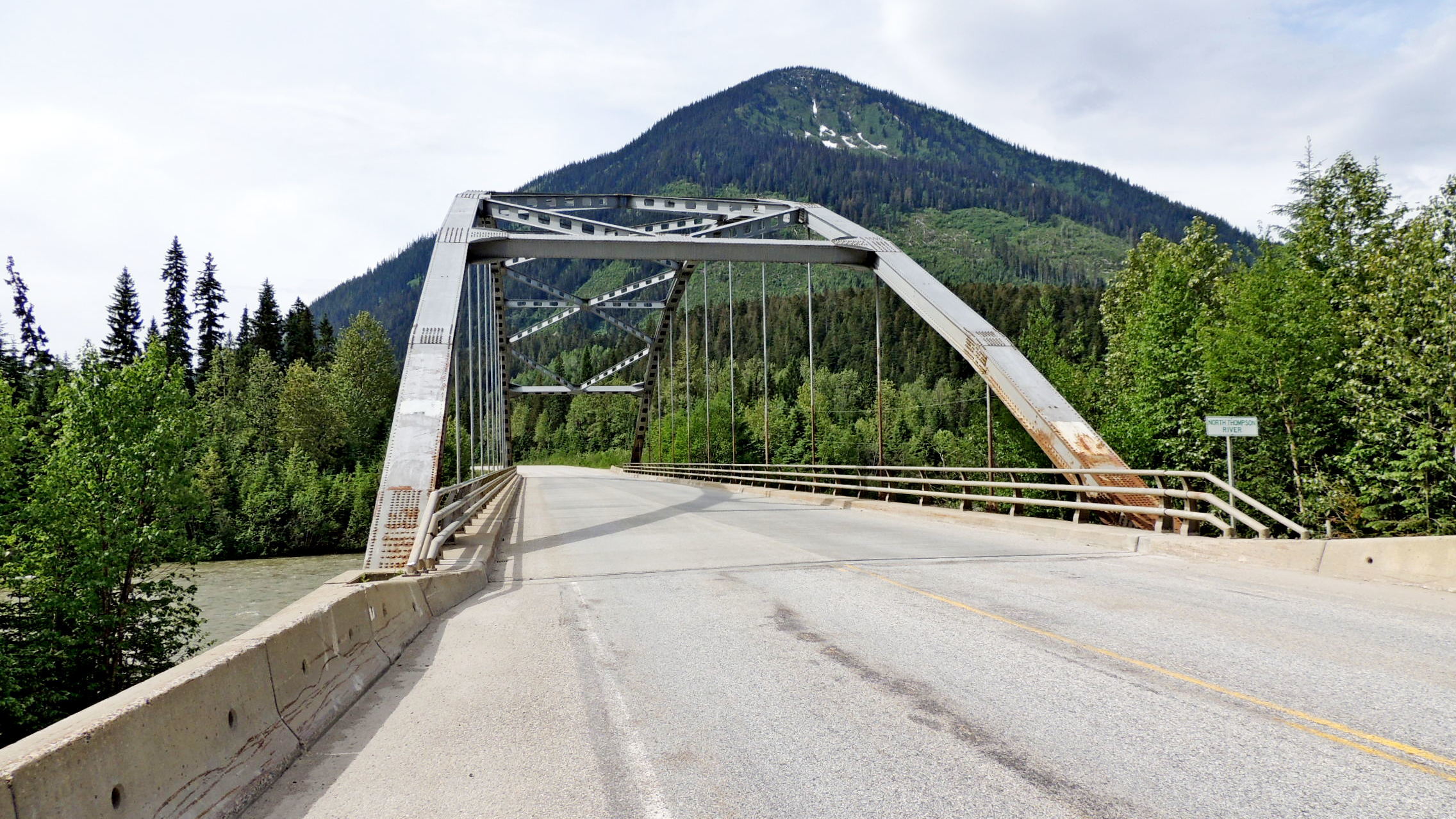
Length of bridge: ~100 metres - 325 feet

What type of traffic does this bridge support?: pedestrians, motor vehicles
What kind of gap does this bridge cross?:
North Thompson River
Date constructed: ca 1967
Is the bridge still in service for its original purpose?: Yes
Name of road or trail the bridge services: Yellowhead Highway
Location:
Nearest town is Valemount, 43 kilometres north.
Height of bridge: Not listed
|
Visit Instructions:
Please submit a photo(s) taken by you of your visit to the location (non-copyrighted photos only). GPS photos are also accepted with the location in the background, and old vacation photos are accepted. If you are not able to provide a photo, then please describe your visit or give a story about the visit. If the bridge location prevents you from taking a safe photograph, then please do not stop to take the photo. Safety is more important.
Recent Visits/Logs:
| There are no logs for this waymark yet. |
|
|
|