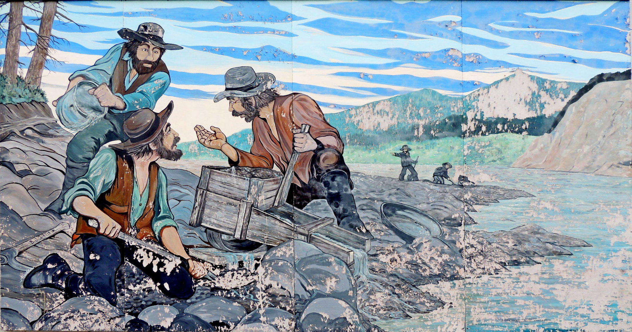
The Gold Miners - Quesnel, BC
Posted by:  T0SHEA
N 52° 58.637 W 122° 29.820
10U E 533774 N 5869862
On the north side of the Scotiabank building, this is yet another of Quesnel's downtown murals.
Waymark Code: WM10XB9
Location: British Columbia, Canada
Date Posted: 07/05/2019
Views: 1
Depicting a scene which quickens the hearts of gold miners, here we have a placer miner who has just found a good sized nugget, drawing the attention of his partners, as well as that of of nearby miners working the same stream.
Using a small rocker box, this group is probably newly arrived on this stream, doing some quick prospecting in hopes of finding some worthwhile diggings.
Given the history of the area, we might believe that this scene takes place on Barkerville's William's Creek, the site of the discovery claim by Billy Barker which led to the Barkerville Gold Rush of 1862.
Barkerville is about 85 road miles east of Quesnel. In 1862 the only road in was a wagon trail from Quesnel. Given that Quesnel was on a main road, as well as the Fraser River, it became the supply point for everyone and everything that went to Barkerville. This bolstered Quesnel and its economy every bit as much as it did Barkerville itself.