|
 Fort Missoula - Missoula, MT Posted by:  T0SHEA T0SHEA
N 46° 50.621 W 114° 03.767
11T E 723947 N 5191982
Established in 1877 as the only permanent military post west of the Continental Divide, Fort Missoula had a long career, outlasting all other Montana forts. Active through two world wars, it was finally decommissioned in 1948, after 71 years.
Waymark Code: WM105R7
Location: Montana, United States
Date Posted: 03/03/2019
Views: 0
In the late 1930s the WPA allotted funds for a number of projects at Fort Missoula. Thes projects included Infrastructure and Utilities, Military and Public Safety, Sanitation and water disposal and Water supply. Of these projects 6 were listed as “ Construct additions to buildings”, 2 were listed as “ Reconstruct and improve buildings and grounds”, 1 as “ Reconstruct, rehabilitate, and improve buildings and grounds”, 1 as “ Improve and rehabilitate buildings, systems, water and sewer lines, and improve grounds”, 1 as “ Reconstruct buildings and improve grounds” and 1 as “ Improve buildings, grounds, and facilities”. Values of the projects ranged from $21,434.00 to $150,000.00. It's not mentioned at Living New Deal, while the Fort's Website mentions " converting the old Fort Chapel into building T-1 (the default pic in the gallery), new guard houses, and a new recreation center".
FORT MISSOULA
Fort Missoula, established in 1877 to provide military control over western Montana’s Indian tribes and protect local settlers, was the only permanent military post west of the Continental Divide. There was little conflict, but the fort’s non-combative service was long and diverse. From 1888 to 1898, the black 25th Infantry Regiment was stationed at the fort. Twenty of the men explored potential military applications of the bicycle, riding 1,900 miles from Missoula to St. Louis in forty days.
During the Spanish-American conflict in 1898, volunteers known as Grigsby’s Cowboys were garrisoned at the fort. Citizens protesting its closure in 1904 prompted U.S. Senator Joseph Dixon of Missoula to successfully lobby for the fort’s reconstruction. Eighteen Mission style buildings from this period (1904 to 1912) form the core of the present complex.
The fort served as a technical training center during World War I, and between 1933 and 1941, it became the nation’s largest regional headquarters for the Civilian Conservation Corps. During World War II, it was the nation’s largest civilian detention camp interning Japanese Americans, Italian nationals taken from merchant and luxury ships in New York’s harbor, and World’s Fair employees. Italian internees affectionately dubbed the fort “Bella Vista.”
After World War II, the fort served as a medium security army prison. Closed in 1948, the fort had a military service that long outlasted other early Montana forts. The army began to sell and lease portions of the property, but adaptability and strong community involvement has assured the buildings at Fort Missoula an active future. Most of the district’s buildings are now administered by the Northern Rockies Heritage Center.
From the NRHP Plaque 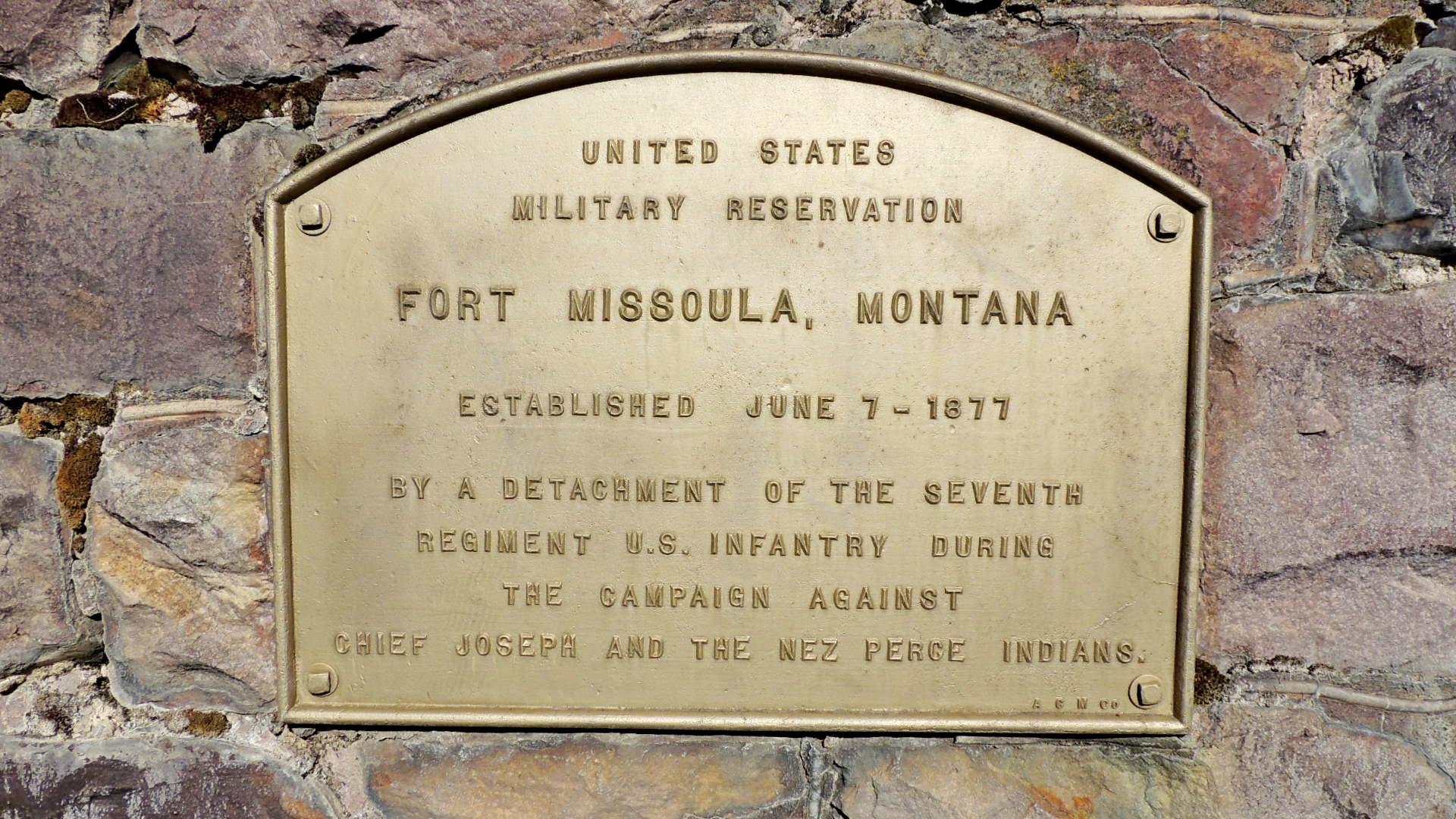
Project type: Government building (non-park)

Date built or created: ca 1939
Location: Fort Missoula
City: Missoula
Condition: Good upkeep with a little wear and tear
Website for additional information: [Web Link]
|
Visit Instructions:
To help give a different perspective and to better the waymark for future visitors please tell us about your visit and upload a favorite photograph you took of the waymark.
Although visiting this waymark in person is the only thing required of you to receive credit for your visit, taking the time to add this information is greatly appreciated.
Recent Visits/Logs:
| There are no logs for this waymark yet. |
|
|
|
|