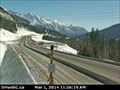
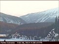
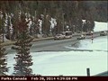
 view gallery view gallery NW12.1 km NW12.1 km
|   Kicking Horse Canyon Web Camera - Golden, BC Kicking Horse Canyon Web Camera - Golden, BC
in Web Cameras This BC Highways Webcam is mounted on a light standard at the western end of the Ten Mile Hill Brake Check pullout on Highway 1. posted by:  T0SHEA T0SHEA location: British Columbia, Canada date approved: 03/02/2014 last visited: 07/28/2014 |
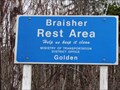 view gallery view gallery SW13.5 km SW13.5 km
|  Braisher Rest Area - Golden, British Columbia Braisher Rest Area - Golden, British Columbia
in Highway Rest Areas Braisher Rest Area is on Highway 95 about 30 km South of Golden. posted by: T0SHEA location: British Columbia, Canada date approved: 05/08/2017 last visited: never |
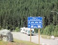 view gallery view galleryNW16.6 km | Kicking Horse Rest Area - Highway 1 in Highway Rest Areas A new rest area located just west of the new Park Bridge on the Trans-Canada Highway. posted by: bcrockcrawler, xstitcher, & BMXer location: British Columbia, Canada date approved: 08/03/2008 last visited: 07/17/2011 |
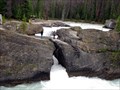 view gallery view gallery N19.3 km N19.3 km
|  Kicking Horse River & Natural Bridge, Yoho Natl Park, BC, Canada Kicking Horse River & Natural Bridge, Yoho Natl Park, BC, Canada
in Places of Geologic Significance This natural wonder is a prime tourist draw. The continuous abrasion of the glacial river has eroded the land into a "natural bridge" and is wildly attractive to see. posted by: Queens Blessing location: British Columbia, Canada date approved: 08/21/2011 last visited: 06/15/2016 |
 view gallery view galleryN19.3 km |  Kicking Horse River a Canadian Heritage River, Yoho Natl Park, BC Kicking Horse River a Canadian Heritage River, Yoho Natl Park, BC
in British Columbia Heritage Markers This river became British Columbia’s FIRST Canadian Heritage River in 1989. It is an example of a glacier fed mountain river. posted by: Queens Blessing location: British Columbia, Canada date approved: 08/22/2011 last visited: 09/19/2018 |
 view gallery view galleryN19.3 km |  Kicking Horse River & Natural Bridge, Yoho Natl Park, BC, Canada Kicking Horse River & Natural Bridge, Yoho Natl Park, BC, Canada
in 'You Are Here' Maps I just LOVE the name of this location! Kicking Horse River, near the Natural Bridge. Boy, if that name doesn't tell a story, what does? posted by: Queens Blessing location: British Columbia, Canada date approved: 08/20/2011 last visited: 06/16/2017 |
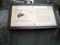
 view gallery view galleryN19.3 km | Canada's First National Internment Operations 1914-1920 in British Columbia Heritage Markers I found this sign with history of the internees from 1914-1920 to be fascinating. Many of the roads and trails in Yoho National Park were built with this labor force. posted by: Queens Blessing location: British Columbia, Canada date approved: 08/22/2011 last visited: 06/16/2017 |
 view gallery view gallery W20.3 km W20.3 km
|  Nicholson Fire Department earns CSRD honour for service Nicholson Fire Department earns CSRD honour for service
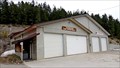
in News Article Locations Along Highway 95 south of Golden, BC, the Nicholson Fire Hall serves the community of Nicholson. posted by: T0SHEA location: British Columbia, Canada date approved: 05/12/2017 last visited: never |
 view gallery view galleryW20.3 km |  Nicholson Fire Deparment Nicholson Fire Deparment
in Firehouses Along Highway 95 south of Golden, BC, the Nicholson Fire Hall serves the community of Nicholson. posted by: T0SHEA location: British Columbia, Canada date approved: 05/12/2017 last visited: never |
 view gallery view gallery NE21.2 km NE21.2 km
| Field West Highway Webcam - Field, BC in Web Cameras This is one of a pair of web cameras mounted atop the visitor centre, just off Highway 1 at the Field Road. posted by: T0SHEA location: British Columbia, Canada date approved: 03/01/2014 last visited: 07/24/2014 |
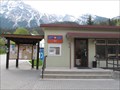 view gallery view galleryNE21.6 km |  Field Post Office V0A 1G0- Field, British Columbia Field Post Office V0A 1G0- Field, British Columbia
in Canada Post Offices This is the small rural post office for Field, British Columbia. posted by:  wildwoodke wildwoodke location: British Columbia, Canada date approved: 06/16/2011 last visited: 07/12/2011 |
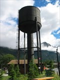 view gallery view galleryNE21.7 km |  Field, British Columbia - Old Wood Water Tower Field, British Columbia - Old Wood Water Tower
in Water Towers This is an old wood water tower that is in great repair and looks to still be in use. posted by: pdxmickey location: British Columbia, Canada date approved: 07/23/2006 last visited: 07/12/2011 |
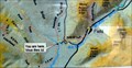
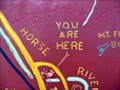 view gallery view galleryNE21.7 km | Field, British Columbia, Canada in 'You Are Here' Maps This HUGE wooden map in Field brags that YOU ARE HERE! posted by: Queens Blessing location: British Columbia, Canada date approved: 08/22/2011 last visited: 09/02/2013 |
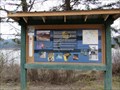 view gallery view gallery S21.9 km S21.9 km
|  Quinn Creek Ecosystem - Parson, British Columbia Quinn Creek Ecosystem - Parson, British Columbia
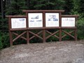
in Flora and Fauna Information Signs About half way between Radium Hot Springs and Golden on Hwy. 95 this sign board is in a large pullout overlooking Quinn Creek. posted by: T0SHEA location: British Columbia, Canada date approved: 05/24/2017 last visited: never |
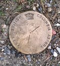
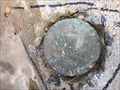 view gallery view galleryNE21.9 km |  GCM361162 - Field, BC GCM361162 - Field, BC
in Canadian Benchmarks Control survey marker in front of St Joseph's Roman Catholic Church on 1st Avenue in Field, British Columbia. posted by: archway location: British Columbia, Canada date approved: 01/06/2018 last visited: never |
 view gallery view galleryNE21.9 km |  The Kicking Horse River - Field, British Columbia The Kicking Horse River - Field, British Columbia
in National Wild and Scenic Rivers The Kicking Horse River is listed on Canada's National Heritage Rivers System. This National Heritage River, the equivalent to a National Wild and Scenic River in the US, is identified by this plaque in Field, British Columbia. posted by: wildwoodke location: Alberta, Canada date approved: 06/01/2012 last visited: 08/04/2019 |
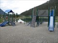 view gallery view galleryNE21.9 km |  Rest Area Playground- Field, British Columbia Rest Area Playground- Field, British Columbia
in Public Playgrounds This playground is located at the rest area for Field, British Columbia. posted by: wildwoodke location: British Columbia, Canada date approved: 06/05/2011 last visited: 06/16/2017 |
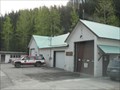 view gallery view galleryNE21.9 km | Yoho National Park Fire Station No. 1 in Firehouses Should there be a fire related emergency this Fire Station will provide first response to the town of Field, British Columbia. posted by: wildwoodke location: British Columbia, Canada date approved: 06/06/2011 last visited: never |
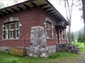 view gallery view galleryNE22 km |  LAST pre-WWII Railway Building in Field, BC LAST pre-WWII Railway Building in Field, BC
in Last of its Kind This 1931 building is the LAST pre-World War II railway building left standing in the town of Field, British Columbia. posted by: Queens Blessing location: British Columbia, Canada date approved: 08/20/2011 last visited: 08/01/2014 |
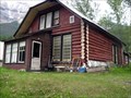 view gallery view galleryNE22 km | Canadian Pacific Railway Log Houses Circa 1928, Field, BC in British Columbia Heritage Markers This old log home was built about 1928, and was a residence for a railway official. posted by: Queens Blessing location: British Columbia, Canada date approved: 08/22/2011 last visited: 08/01/2014 |
 view gallery view galleryNE22 km | 1999 - 16569 - BC Legal Survey marker in Canadian Benchmarks 1999 - 16569 - BC Legal Survey marker posted by: Berkut location: British Columbia, Canada date approved: 02/20/2021 last visited: never |
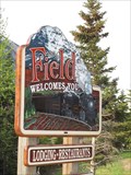 view gallery view galleryNE22 km |  Field, British Columbia Field, British Columbia
in Artistic Welcome Signs This welcome sign is found at the bridge into the town of Field, British Columbia. posted by: wildwoodke location: Alberta, Canada date approved: 06/07/2011 last visited: 06/16/2017 |
 view gallery view galleryNE22 km | Field East Highway Webcam - Field, BC in Web Cameras This is one of a pair of web cameras mounted atop the visitor centre, just off Highway 1 at the Field Road. posted by: T0SHEA location: British Columbia, Canada date approved: 03/01/2014 last visited: 07/24/2014 |
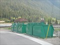 view gallery view galleryNE22 km |  DO - Field, British Columbia DO - Field, British Columbia
in Places for Recycling This drop off is located to collect the recyclables and compostables of the town of Field, British Columbia. posted by: wildwoodke location: British Columbia, Canada date approved: 06/06/2011 last visited: 08/01/2014 |
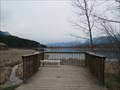 view gallery view galleryW24.1 km |  Reflection Lake - Golden, British Columbia Reflection Lake - Golden, British Columbia
in Birdwatching Locations This bird watching location overlooks the beautiful Reflection Lake near Golden. posted by: T0SHEA location: British Columbia, Canada date approved: 05/23/2017 last visited: never |
|