 view gallery view gallery SW2.6 km SW2.6 km
|   Huntsdale Fish Hatchery, Cumberland County - PA Huntsdale Fish Hatchery, Cumberland County - PA
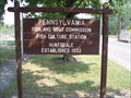
in Fish Hatcheries Huntsdale Fish Hatchery is situated along Lebo Road near Carlisle, Cumberland County, Pennsylvania. posted by:  deano1943 deano1943 location: Pennsylvania date approved: 07/28/2008 last visited: 11/08/2015 |
 view gallery view gallery SE2.7 km SE2.7 km
|  Mansion Gardens at Kings Gap - Carlisle, Pennsylvania, USA Mansion Gardens at Kings Gap - Carlisle, Pennsylvania, USA
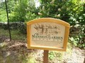
in Demonstration Gardens The Mansion Garden was established Circa 1910. Located at Kings Mansion State Park, Carlisle, PA. posted by: ted28285 location: Pennsylvania date approved: 09/15/2022 last visited: 09/26/2022 |
 view gallery view gallerySE2.7 km |  Kings Gap Water Tower - Cumberland County, PA Kings Gap Water Tower - Cumberland County, PA
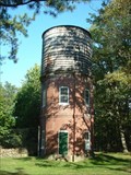
in Water Towers Unique old water tower located on the grounds of the Kings Gap Environmental Center. posted by: Ernmark location: Pennsylvania date approved: 12/18/2006 last visited: 07/08/2022 |
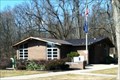
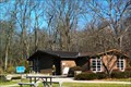
 view gallery view gallerySE2.7 km |  Kings Gap Environmental Education Center - Carlisle, PA Kings Gap Environmental Education Center - Carlisle, PA
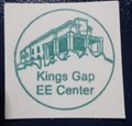
in State Park Passport Locations This stamp station is located in the Education Building. posted by: r.e.s.t.seekers location: Pennsylvania date approved: 07/31/2022 last visited: 08/14/2022 |
 view gallery view gallery NW4.5 km NW4.5 km
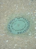
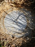
|  PennDOT - (I-81 Mi. 39.3) - Cumberland Co., PA PennDOT - (I-81 Mi. 39.3) - Cumberland Co., PA
in U.S. Benchmarks PennDOT unstamped 'survey control mark' located SE of the northbound lanes on a bridge carrying I-81 over Mt.Rock Rd. posted by: Ernmark location: Pennsylvania date approved: 12/30/2006 last visited: never |
 view gallery view gallery N4.7 km N4.7 km
| PennDOT - (I-81 Mi. 40.0) - Cumberland Co., PA in U.S. Benchmarks Unstamped PennDOT disk located SE of the northbound lanes on the SW end of a bridge 'bannister' wall carrying I-81 over Stonehouse Rd. posted by: Ernmark location: Pennsylvania date approved: 12/30/2006 last visited: never |
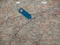 view gallery view galleryNW4.7 km |  Interstate 81S Rest Area - Newville, PA Interstate 81S Rest Area - Newville, PA
in 'You Are Here' Maps The map in the Newville, PA, rest area on I81 keeps travelers heading in the right direction. posted by:  Janila Janila location: Pennsylvania date approved: 12/22/2018 last visited: never |
 view gallery view galleryNW4.7 km |  Interstate 81 Southbound Rest Area - Newville, Pennsylvania Interstate 81 Southbound Rest Area - Newville, Pennsylvania
in Highway Rest Areas This rest area serves travelers heading Southbound on Interstate 81 at Milepost 38 in Penn Township, Cumberland County, Pennsylvania posted by: outdoorboy34 location: Pennsylvania date approved: 05/08/2013 last visited: 12/17/2018 |
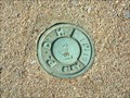
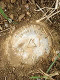
 view gallery view gallery W4.8 km W4.8 km
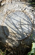
| Y 164 RESET 1970 in U.S. Benchmarks U.S. Coast & Geodetic Survey benchmark about 5 miles SE of Newville, PA. It appears to have never made it into the database and was meant to replace Y 164 (KW2053) which was most likely destroyed when the highway was realigned. posted by: Ernmark location: Pennsylvania date approved: 07/03/2006 last visited: never |
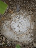
 view gallery view galleryN5 km | P.D.H. Elev. 611.11 - (I-81 Mi. 40.7) - Cumberland County, PA in U.S. Benchmarks PA Dept of Highways disk located on the SE side of the northbound lanes & on the S side of westernmost abutment of a bridge carrying I-81 over Mooredale Rd. posted by: Ernmark location: Pennsylvania date approved: 12/30/2006 last visited: never |
 view gallery view galleryNW5 km | P.D.H. Elev. 622.75 - (I-81 Mi. 38.0) - Cumberland Co., PA in U.S. Benchmarks PA Dept. of Highways (now PennDOT) disk on a abutment of a bridge carrying I-81 over Kutz Rd. posted by: Ernmark location: Pennsylvania date approved: 12/30/2006 last visited: never |
 view gallery view galleryW5.5 km | Interstate 81 Northbound Rest Area - Newville, Pennsylvania in Highway Rest Areas This rest area serves travelers heading Northbound on Interstate 81 at Milepost 38 in Penn Township, Cumberland County, Pennsylvania posted by: outdoorboy34 location: Pennsylvania date approved: 05/08/2013 last visited: 03/24/2023 |
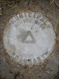 view gallery view gallery E5.8 km E5.8 km
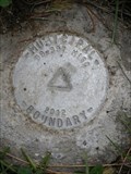
| Dickinson/South Middleton Township Boundary - Creekview DR in U.S. Benchmarks Monument placed along the N side of Creekview DR in 2012 to mark the official border between Dickinson & South Middleton Townships in Cumberland County, PA. posted by: Ernmark location: Pennsylvania date approved: 05/04/2012 last visited: never |
 view gallery view galleryN5.8 km | P.D.H. Elev. 564.485 - (I-81 Mi. 41.6) - Cumberland Co., PA in U.S. Benchmarks PA Dept. of Highways (now PennDOT) disk located SE of the northbound lanes on a bridge carrying I-81 over Burnthouse Rd. posted by: Ernmark location: Pennsylvania date approved: 12/30/2006 last visited: never |
 view gallery view galleryE5.8 km | Dickinson/South Middleton Township Boundary - Pine RD in U.S. Benchmarks Monument placed along the S side of Pine RD in 2012 to mark the official border between Dickinson & South Middleton Townships in Cumberland County, PA. posted by: Ernmark location: Pennsylvania date approved: 05/04/2012 last visited: never |
 view gallery view gallery NE5.8 km NE5.8 km
| Dickinson/South Middleton Township Boundary - Old York RD (S) in U.S. Benchmarks Monument placed along the S side of Old York RD in 2012 to mark the official border between Dickinson & South Middleton Townships in Cumberland County, PA. posted by: Ernmark location: Pennsylvania date approved: 05/04/2012 last visited: never |
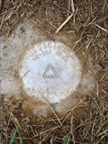 view gallery view galleryNE5.8 km | Dickinson/South Middleton Township Boundary - Old York RD (N) in U.S. Benchmarks Monument placed along the N side of Old York RD in 2012 to mark the official border between Dickinson & South Middleton Townships in Cumberland County, PA. posted by: Ernmark location: Pennsylvania date approved: 05/04/2012 last visited: never |
 view gallery view galleryE6 km | Dickinson/South Middleton Township Boundary - W Pine ST in U.S. Benchmarks Monument placed along the N side of W Pine ST in 2012 to mark the official border between Dickinson & South Middleton Townships in Cumberland County, PA. posted by: Ernmark location: Pennsylvania date approved: 06/01/2012 last visited: never |
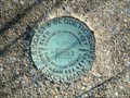
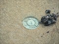
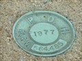
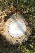
 view gallery view galleryNW6 km | G 002 - Penn.D.O.T. in U.S. Benchmarks Pennsylvania Dept. of Transportation bronze disk monumented in 2006 posted by: Ernmark location: Pennsylvania date approved: 06/09/2006 last visited: never |
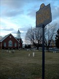 view gallery view galleryNW6 km |  Joseph Ritner Joseph Ritner
in Pennsylvania Historical Markers Historical marker noting a 19th century Pennsylvania Governor. posted by: Ernmark location: Pennsylvania date approved: 02/24/2008 last visited: never |
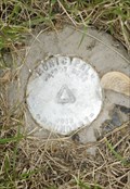
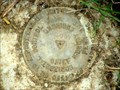 view gallery view galleryNW6 km | G 001 - Penn.D.O.T. in U.S. Benchmarks Pennsylvania Dept. of Transportation bronze disk monumented in 2006 posted by: Ernmark location: Pennsylvania date approved: 06/09/2006 last visited: never |
 view gallery view galleryE6.1 km | Dickinson/South Middleton Township Boundary - Sandbank RD in U.S. Benchmarks Monument placed along the N side of Sandbank RD in 2012 to mark the official border between Dickinson & South Middleton Townships in Cumberland County, PA. posted by: Ernmark location: Pennsylvania date approved: 06/01/2012 last visited: never |
 view gallery view galleryNE6.1 km | Dickinson/South Middleton Township Boundary - Adams RD in U.S. Benchmarks Monument placed along Adams RD in 2012 to mark the official border between Dickinson & South Middleton Townships in Cumberland County, PA posted by: Ernmark location: Pennsylvania date approved: 05/04/2012 last visited: never |
 view gallery view galleryNE6.3 km | Dickinson/South Middleton Township Boundary - E Oakwood DR in U.S. Benchmarks Monument placed along E Oakwood DR in 2012 to mark the official border between Dickinson & South Middleton Townships in Cumberland County, PA. posted by: Ernmark location: Pennsylvania date approved: 05/04/2012 last visited: never |
 view gallery view galleryNE6.3 km | Dickinson/South Middleton Township Boundary - Briarwood LN in U.S. Benchmarks Monument placed along the NW side of Briarwood LN in 2012 to mark the official border between Dickinson & South Middleton Townships in Cumberland County, PA. posted by: Ernmark location: Pennsylvania date approved: 05/04/2012 last visited: never |
|