 view gallery view gallery SW2.6 km SW2.6 km
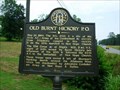
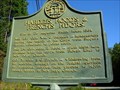
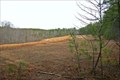
|   Old Burnt Hickory P.O.-GHM-110-3-Paulding Co.,GA. Old Burnt Hickory P.O.-GHM-110-3-Paulding Co.,GA.
in Georgia Historical Markers Located on Hwy 92 at Willis Grocery posted by:  Sprinterman Sprinterman location: Georgia date approved: 06/14/2008 last visited: 12/29/2015 |
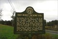 view gallery view gallerySW2.6 km |  Old Burnt Hickory P.O. - Bunrt Hickory, GA Old Burnt Hickory P.O. - Bunrt Hickory, GA
in American Civil War Monuments and Memorials Another faze of Sherman's march to the sea. posted by:  YoSam. YoSam. location: Georgia date approved: 05/25/2019 last visited: never |
 view gallery view gallerySW2.6 km |  Will's Grocery - Burnt Hickory, GA Will's Grocery - Burnt Hickory, GA
in Vintage Gas Stations In 2000, when metal gas tanks were outlawed, the store ceased its fuel business. posted by: YoSam. location: Georgia date approved: 01/01/2016 last visited: never |
 view gallery view gallerySW2.6 km |  Will's Grocery - Burnt Hickory, GA Will's Grocery - Burnt Hickory, GA
in Coca Cola Memorabilia Sign erected in 1953 posted by: YoSam. location: Georgia date approved: 12/29/2015 last visited: never |
 view gallery view gallerySW2.6 km |  Will's Grocery - Burnt Hickory, GA Will's Grocery - Burnt Hickory, GA
in The Local Neighborhood Grocer 'Aunt Mae's' a Community Gathering Place posted by: YoSam. location: Georgia date approved: 12/30/2015 last visited: never |
 view gallery view gallery S7.6 km S7.6 km
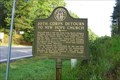
| 20th Corps Detours to New Hope Church - Paulding County, GA in American Civil War Monuments and Memorials 20th Corps Detours to New Hope Church, Ga 61 at the intersection with Sand Grove Church Road. posted by: YoSam. location: Georgia date approved: 05/24/2019 last visited: never |
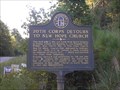 view gallery view galleryS7.7 km | 20th Corps Detours to New Hope Church - Paulding County in Georgia Historical Markers 20th Corps Detours to New Hope Church GHM 110-4 Ga 61 at the (southernmost) intersection with High Shoals Rd. posted by: GA Cacher location: Georgia date approved: 09/25/2007 last visited: 08/06/2016 |
 view gallery view gallery SE7.7 km SE7.7 km
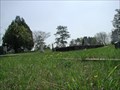
|  Crossroads Baptist Church Cemetery, Crossroads, Paulding Co., GA Crossroads Baptist Church Cemetery, Crossroads, Paulding Co., GA
in Worldwide Cemeteries Crossroads Baptist Church Cemetery located on Credarcrest Rd, just west of the intersection on the Dallas Acworth Highway and Hiram Acworth Highway. posted by: Lat34North location: Georgia date approved: 04/16/2008 last visited: 04/09/2008 |
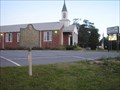
 view gallery view gallerySE7.9 km | Cross Roads Church - GHM 110-26 - Paulding Co., GA in Georgia Historical Markers Cross Roads Church state historic marker located on Ga 92 at crossroads with Ga 381 NE of New Hope, GA. posted by: Lat34North location: Georgia date approved: 11/19/2008 last visited: 06/01/2003 |
 view gallery view gallerySE7.9 km |  McDonald's - Dallas Acworth Hwy - Dallas, GA McDonald's - Dallas Acworth Hwy - Dallas, GA
in McDonald's Restaurants McDonald's located on the Dallas Acworth Highway (route 92). posted by: Lat34North location: Georgia date approved: 04/13/2008 last visited: 04/09/2008 |
 view gallery view gallery E8.5 km E8.5 km
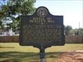
| HARDEE'S, HOOD'S & FRENCH'S H'DQRS-GHM-110-1 in Georgia Historical Markers Located on Ga 92 (Dallas-Acworth Hwy) at the Paulding Cobb county line posted by: Sprinterman location: Georgia date approved: 10/22/2007 last visited: 06/01/2003 |
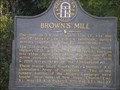 view gallery view gallerySE8.7 km | Brown's Mill , GHM 110-28A , Paulding County in Georgia Historical Markers Brown's Mill GHM 110-28A Ga 381 at Pickett's Mill Rd, NE of New Hope Church posted by: GA Cacher location: Georgia date approved: 09/25/2007 last visited: 06/01/2003 |
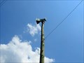 view gallery view gallery NE8.9 km NE8.9 km
|  Bartow Co. Siren # 30 Bartow Co. Siren # 30
in Outdoor Warning Sirens Located at the intersection of Bates Rd and Puckett Rd in Cartersville. posted by: Sprinterman location: Georgia date approved: 06/10/2008 last visited: 06/11/2008 |
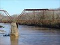 view gallery view gallery N9.2 km N9.2 km
|  Douthit Bridge, Cartersville, GA Douthit Bridge, Cartersville, GA
in Truss Bridges Douthit Bridge, Cartersville, GA posted by: trekinldy59 location: Georgia date approved: 09/05/2006 last visited: 09/05/2006 |
 view gallery view gallerySE9.2 km |  Battle of Picketts Mill - near Dallas, GA. Battle of Picketts Mill - near Dallas, GA.
in Battlefields Sherman lost 3000 men at Pickett's Mill on Friday, May 27, 1864. This was his worst defeat along with the Battle of Kennesaw Mountain during the whole campaign for Atlanta. This area was called, "The Hell Hole", by Sherman's troops. posted by: GeorgiaDawg83 location: Georgia date approved: 07/26/2008 last visited: 11/26/2011 |
 view gallery view galleryNE9.3 km | Pumpkinvine Creek Truss Bridge - Emerson, Ga. in Truss Bridges Old single lane truss bridge over Pumpkinvine Creek outside of Emerson, Georgia posted by: Atlanta Highland Bagpiper location: Georgia date approved: 04/18/2015 last visited: never |
 view gallery view galleryN9.5 km |  Cartersville-Bartow County Airport - Cartersville, GA Cartersville-Bartow County Airport - Cartersville, GA
in Airports The Cartersville-Bartow County Airport, a general aviation
airport, is currently ranked first in the Coosa Valley/North Georgia Regional Development Area posted by: Atlanta Highland Bagpiper location: Georgia date approved: 01/06/2007 last visited: 01/06/2007 |
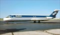 view gallery view gallerySE9.5 km |  Southern Airways, Flight 242 New Hope, Georgia Southern Airways, Flight 242 New Hope, Georgia
in Plane Crash Sites Aircraft crashed onto highway at waypoint. posted by: Atlanta Highland Bagpiper location: Georgia date approved: 11/16/2005 last visited: 01/27/2013 |
 view gallery view galleryE9.7 km | Cobb County Siren #71, Cobb County, Georgia in Outdoor Warning Sirens Located at intersection of Dallas-Acworth Hwy. and Cheatham posted by: Sprinterman location: Georgia date approved: 08/08/2008 last visited: 07/12/2014 |
 view gallery view gallerySE9.7 km | Battle of Pickett's Mill, Paulding County in Georgia Historical Markers Battle of Pickett's Mill State Historical Marker
Located on Mt. Tabor Rd. at the entrance to Pickett's Mill Historic Site
posted by: GA Cacher location: Georgia date approved: 09/24/2007 last visited: 06/01/2003 |
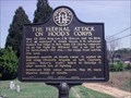 view gallery view gallerySE9.7 km | The Federal Attack on Hood's Corps - GHM 110-24 - Paulding Co., GA in Georgia Historical Markers At the New Hope cemetery across Ga 381 from New Hope Baptist Church at Chester Harris Dr. Follow the road around the cemetery to the marker. posted by: Lat34North location: Georgia date approved: 04/10/2008 last visited: 06/01/2003 |
 view gallery view galleryN9.8 km | Bartow Co. Siren # 31 in Outdoor Warning Sirens Located Hwy 113 & Friction Drive posted by: Sprinterman location: Georgia date approved: 07/21/2008 last visited: 07/19/2008 |
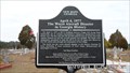 view gallery view gallerySE9.8 km | The Worst Aircraft Disaster In Georgia History-Paulding Co in Georgia Historical Markers Located on Acworth Dallas Highway across from New Hope Baptist Church in New Hope Cemetery. posted by: Sprinterman location: Georgia date approved: 01/27/2013 last visited: 01/27/2013 |
 view gallery view gallerySE9.8 km | New Hope Cemetery – Paulding Co., GA USA in Worldwide Cemeteries New Hope Cemetery located on Dallas Acworth Highway (381) at Chester Harris Drive, across the street from the New Hope Church. posted by: Lat34North location: Georgia date approved: 04/16/2008 last visited: 01/27/2013 |
 view gallery view gallerySE9.8 km |  The Battle of New Hope Church The Battle of New Hope Church
in Wikipedia Entries The Battle of New Hope Church was fought on May 25 and May 26 of 1864 between Sherman's Union force and Johnston's Confederate force. posted by: GA Cacher location: Georgia date approved: 09/25/2007 last visited: 04/09/2008 |
|