 view gallery view gallery NE1.4 km NE1.4 km
|   Box Canyon - Hornblende Canyon, CA Box Canyon - Hornblende Canyon, CA
in Wagon Roads and Trails One of a few California State Historical Markers in northeastern San Diego County. posted by:  bluesnote bluesnote location: California date approved: 09/28/2021 last visited: never |
 view gallery view gallery NE1.4 km NE1.4 km
|   FIRST -- Road into Southern California - Hornblende Canyon, CA FIRST -- Road into Southern California - Hornblende Canyon, CA
in First of its Kind One of a few California State Historical Markers in northeastern San Diego County. posted by:  bluesnote bluesnote location: California date approved: 09/27/2021 last visited: 09/27/2021 |
 view gallery view gallery NE1.4 km NE1.4 km
|   Box Canyon - Hornblende Canyon, CA Box Canyon - Hornblende Canyon, CA
in LDS Church History Sites One of a few California State Historical Markers in northeastern San Diego County. posted by:  bluesnote bluesnote location: California date approved: 09/27/2021 last visited: never |
 view gallery view gallery NE1.4 km NE1.4 km
|   Box Canyon - Hornblende Canyon, CA Box Canyon - Hornblende Canyon, CA
in California Historical Markers One of a few California State Historical Markers in northeastern San Diego County. posted by:  bluesnote bluesnote location: California date approved: 10/09/2021 last visited: never |
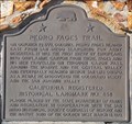 view gallery view gallery W8.2 km W8.2 km
|   First Europeans to Enter Oriflamme Canyon First Europeans to Enter Oriflamme Canyon
in First of its Kind Colonel Pedro Fages and his troops the first Europeans to enter Oriflamme Canyon. posted by:  brwhiz brwhiz location: California date approved: 09/29/2013 last visited: 08/09/2014 |
 view gallery view gallery E9.2 km E9.2 km
|   What do They Mean? - Blair Canyon, CA What do They Mean? - Blair Canyon, CA
in Signs of History The trailhead to the pictographs that are likely thousands of years old in Anza-Borrego State Park. posted by:  bluesnote bluesnote location: California date approved: 09/27/2021 last visited: never |
 view gallery view gallery E9.2 km E9.2 km
|   Pictograph Trail - Blair Canyon, CA Pictograph Trail - Blair Canyon, CA
in Hiking and walking trailheads The trailhead to the pictographs that are likely thousands of years old in Anza-Borrego State Park. posted by:  bluesnote bluesnote location: California date approved: 09/27/2021 last visited: never |
 view gallery view gallery W9.2 km W9.2 km
|   9 1/2 MPH at the KQ Ranch in Julian Ca. 9 1/2 MPH at the KQ Ranch in Julian Ca.
in Unusual Speed Limits An odd numbered speed limit sign in one of our favorite campgrounds posted by:  Moag Ohana Moag Ohana location: California date approved: 01/14/2008 last visited: never |
 view gallery view gallery N9.7 km N9.7 km
|   Pacific Crest Trail - Julian, CA Pacific Crest Trail - Julian, CA
in Long Distance Hiking Trails A trailhead for the Pacific Crest Trail near Julian, California. posted by:  bluesnote bluesnote location: California date approved: 01/16/2022 last visited: never |
 view gallery view gallery N9.7 km N9.7 km
|   Pacific Crest Trail - Julian, CA Pacific Crest Trail - Julian, CA
in Hiking and walking trailheads A trailhead for the Pacific Crest Trail near Julian, California. posted by:  bluesnote bluesnote location: California date approved: 01/04/2022 last visited: never |
 view gallery view gallery N9.8 km N9.8 km
|   Vallecito-Butterfield Stage Station - Shelter Valley, CA Vallecito-Butterfield Stage Station - Shelter Valley, CA
in Wagon Roads and Trails One of a few California State Historical Markers in northeastern San Diego County. posted by:  bluesnote bluesnote location: California date approved: 09/28/2021 last visited: never |
 view gallery view gallery N9.8 km N9.8 km
|   Vallecito-Butterfield Stage Station - Shelter Valley, CA Vallecito-Butterfield Stage Station - Shelter Valley, CA
in California Historical Markers One of a few California State Historical Markers in northeastern San Diego County. posted by:  bluesnote bluesnote location: California date approved: 10/09/2021 last visited: never |
 view gallery view gallery N9.8 km N9.8 km
|   Vallecito-Butterfield Stage Station - Shelter Valley, CA Vallecito-Butterfield Stage Station - Shelter Valley, CA
in Cairns One of a few California State Historical Markers in northeastern San Diego County. posted by:  bluesnote bluesnote location: California date approved: 02/19/2022 last visited: never |
 view gallery view gallery N9.8 km N9.8 km
|   First Stage Departure on the Butterfield Stage Line First Stage Departure on the Butterfield Stage Line
in First of its Kind The first stage on the Butterfield Stage Line left St. Louis on September 15, 1858. posted by:  brwhiz brwhiz location: California date approved: 09/29/2013 last visited: 09/27/2021 |
 view gallery view gallery E10.1 km E10.1 km
|   Blair Valley Pictographs - Blair Valley, CA Blair Valley Pictographs - Blair Valley, CA
in New World Ancient Evidence Pictographs that are likely thousands of years old in Anza Borrego State Park. It's a 1 mile hike from the trailhead, which requies a 4x4 to reach. posted by:  bluesnote bluesnote location: California date approved: 10/11/2021 last visited: never |
 view gallery view gallery E10.1 km E10.1 km
|   Blair Valley Pictographs - Blair Valley, CA Blair Valley Pictographs - Blair Valley, CA
in Official Local Tourism Attractions Pictographs that are likely thousands of years old in Anza Borrego State Park. It's a 1 mile hike from the trailhead, which requires a 4x4 to reach. posted by:  bluesnote bluesnote location: California date approved: 09/27/2021 last visited: never |
 view gallery view gallery E10.1 km E10.1 km
|   Blair Valley Pictographs - Blair Valley, CA Blair Valley Pictographs - Blair Valley, CA
in Pictographs Pictographs that are likely thousands of years old in Anza Borrego State Park. It's a 1 mile hike from the trailhead, which requies a 4x4 to reach. posted by:  bluesnote bluesnote location: California date approved: 09/29/2021 last visited: never |
 view gallery view gallery N10.6 km N10.6 km
|   San Felipe San Felipe
in E Clampus Vitus Historical Markers This E Clampus Vitus Marker is on a small rise above the Great Overland Stage Route of 1849 (County Road S-2) about 1 mile north of California Highway 78. posted by:  brwhiz brwhiz location: California date approved: 09/28/2013 last visited: 02/19/2021 |
 view gallery view gallery NW11.9 km NW11.9 km
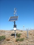
|   JULIANBIN_CS2004 CORS ARP JULIANBIN_CS2004 CORS ARP
in U.S. Benchmarks This is a GPS Continuously Operating Reference Station(CORS) This is a This is a Plate Boundary Observatory designated as DG8356 in the NGS DataBase. The coordinates shown are for the GPS station. posted by:  MIG2 MIG2 location: California date approved: 02/09/2012 last visited: never |
  S13.2 km S13.2 km
|   Laguna Mountain Bedrock Mortar Laguna Mountain Bedrock Mortar
in New World Ancient Evidence A distinct bedrock mortar was found near the "lagunas" on Laguna Mountain while hiking the area to find several Geocaches. posted by:  Miragee Miragee location: California date approved: 07/05/2006 last visited: never |
 view gallery view gallery S13.2 km S13.2 km
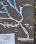
|   Laguna Campground Laguna Campground
in 'You Are Here' Maps You Are Here at the entrance to the Laguna Campground in the Laguna Mountains east of San Diego. posted by:  brwhiz brwhiz location: California date approved: 11/11/2013 last visited: never |
 view gallery view gallery S13.2 km S13.2 km
|   Laguna Campground Laguna Campground
in Campgrounds This popular Campground is located on Mount Laguna. posted by:  brwhiz brwhiz location: California date approved: 09/29/2013 last visited: never |
 view gallery view gallery S13.7 km S13.7 km
|   Lake Laguna Trail - Mt. Laguna, CA Lake Laguna Trail - Mt. Laguna, CA
in Hiking and walking trailheads The trailhead to California's oldest active geocache. posted by:  bluesnote bluesnote location: California date approved: 06/24/2017 last visited: 06/24/2017 |
 view gallery view gallery S13.7 km S13.7 km
|   The Laguna Mountains Skipper - Mt. Laguna, CA The Laguna Mountains Skipper - Mt. Laguna, CA
in Flora and Fauna Information Signs A pair of two signs at the trailhead for the Laguna Meadows, where the oldest active geocache in California is hidden. posted by:  bluesnote bluesnote location: California date approved: 03/09/2017 last visited: 03/09/2017 |
 view gallery view gallery S13.7 km S13.7 km
|   You are Entering a Working Landscape - Mt. Laguna, CA You are Entering a Working Landscape - Mt. Laguna, CA
in Flora and Fauna Information Signs A pair of two signs at the trailhead for the Laguna Meadows, where the oldest active geocache in California is hidden. posted by:  bluesnote bluesnote location: California date approved: 03/09/2017 last visited: 03/09/2017 |
|