 view gallery view gallery NE3.1 km NE3.1 km
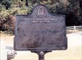
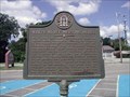
|   Nicholsonboro GHM 025-92 Nicholsonboro GHM 025-92
in Georgia Historical Markers On the corner of White Bluff Rd, Old Coffee Bluff Rd. and Coffee Bluff Rd in the Nicholsonboro community, south of Savannah. posted by:  Markerman62 Markerman62 location: Georgia date approved: 04/23/2015 last visited: 08/01/1998 |
 view gallery view galleryNE4.3 km | Capture of the USS "Water Witch" - GHM 025-51 - Chatham Co., GA in Georgia Historical Markers Located on Dancy Ave. 0.1 mile from Davidson Ave., Savannah posted by:  Lat34North Lat34North location: Georgia date approved: 09/05/2008 last visited: 04/13/2003 |
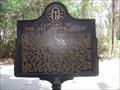
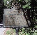 view gallery view gallery E4.3 km E4.3 km
| Site of Colonial Shipyard - GHM 025-66 - Chatham Co., GA in Georgia Historical Markers Located on Shipyard Rd, 0.2 mile east of Ferguson Rd., Savannah. posted by: Lat34North location: Georgia date approved: 09/05/2008 last visited: 03/22/2019 |
 view gallery view gallery N5.1 km N5.1 km
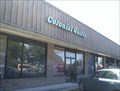
|  Colonial Quilts - Savannah, Georgia Colonial Quilts - Savannah, Georgia
in Quilt Shops "This shop has a great selection of fabric and a friendly, helpful staff," according to my quilting enthusiast wife. And for me, there's a few good geocaches around, and now a waymark. posted by: Scooter Bill location: Georgia date approved: 10/30/2007 last visited: 02/25/2019 |
 view gallery view galleryE5.3 km |  1961 - Sweet Field of Eden Baptist Church - Savannah, Ga. 1961 - Sweet Field of Eden Baptist Church - Savannah, Ga.
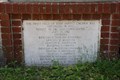
in Dated Buildings and Cornerstones This dated stone is located on the front wall of the Sweet Field of Eden Baptist Church, 9630 Lehigh Avenue, Savannah, Ga. posted by: Lat34North location: Georgia date approved: 03/16/2014 last visited: 03/20/2019 |
 view gallery view galleryE5.3 km |  The Sweet Field of Eden Baptist Church - Savannah, GA The Sweet Field of Eden Baptist Church - Savannah, GA
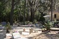
in Churchyard Cemeteries The Sweet Field of Eden Baptist Church, 9630 Lehigh Avenue, Savannah, Ga. posted by: Lat34North location: Georgia date approved: 03/18/2014 last visited: 05/25/2019 |
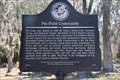 view gallery view galleryE5.3 km | Pin Point Community - GHS 25-40 - Chatham Co., GA in Georgia Historical Markers Pin Point was settled in 1896 by former slaves from Ossabaw, Green, and Skidaway Islands. Located at the Sweetfield of Eden Baptist Church, 9630 Lehigh Avenue, Savannah, Ga. posted by: Lat34North location: Georgia date approved: 03/22/2014 last visited: 05/25/2019 |
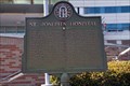 view gallery view galleryN5.5 km | St. Joseph's Hospital - GHM 025-94 - Chatham Co., GA in Georgia Historical Markers Located at the hospital, on Mercy Blvd. between Abercorn Street (State Road 204) and McAuley Drive, Savannah GA posted by: Lat34North location: Georgia date approved: 03/22/2014 last visited: 05/16/2024 |
 view gallery view galleryNE6 km | White Bluff Meeting House - GHM 025-92 - Chatham Co., GA in Georgia Historical Markers Located at White Bluff Presbyterian Church, 10710 White Bluff Rd. posted by: Lat34North location: Georgia date approved: 09/05/2008 last visited: 03/20/2019 |
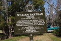 view gallery view galleryNE6.3 km | William Bartram Trail - Chatham Co., GA in Georgia Historical Markers The marker is located at the William H. Ford, Sr. Museum and Visitors Center on Old Montgomery Rd, Savannah, GA. posted by: Lat34North location: Georgia date approved: 03/22/2014 last visited: 05/25/2019 |
 view gallery view galleryNE6.3 km |  William Bartram Trail - Chatham Co., GA William Bartram Trail - Chatham Co., GA
in Bartram Trail Historical Markers The marker is located at the William H. Ford, Sr. Museum and Visitors Center on Old Montgomery Rd, Savannah, GA. posted by: Lat34North location: Georgia date approved: 03/16/2014 last visited: 05/25/2019 |
 view gallery view gallery SW6.4 km SW6.4 km
|  Savage Island Campground-Richmond Hill, GA 31324 Savage Island Campground-Richmond Hill, GA 31324
in Campgrounds Savage Island Campground 3894 Fort McAllister Road, Richmond Hill, GA. posted by: walkingwildly location: Georgia date approved: 04/19/2014 last visited: 03/22/2019 |
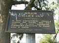 view gallery view gallerySW6.4 km | Major Gallie's Gun Historical Marker in Georgia Historical Markers Major Gallie's Gun Historical Marker at Fort McAllister Historic Site posted by: onfire4jesus location: Georgia date approved: 06/27/2007 last visited: 02/28/2019 |
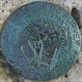
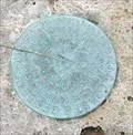 view gallery view gallerySW6.4 km |  BR1095 - Fort Mcallister, GA BR1095 - Fort Mcallister, GA
in U.S. Benchmarks BR1095 is located on the S bank of the Ogeechee River, on Savage Island near the earth breast works of the old Ft. McAllister. (State park - Fee area) posted by: Lat34North location: Georgia date approved: 03/25/2012 last visited: 02/28/2019 |
 view gallery view gallerySW6.4 km | Position of the Monitors Historical Marker in Georgia Historical Markers Position of the Monitors Historical Marker at Fort McAllister Historic Site posted by: onfire4jesus location: Georgia date approved: 06/27/2007 last visited: 02/28/2019 |
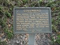 view gallery view gallerySW6.4 km | Columbiad Historical Marker in Georgia Historical Markers Columbiad Historical Marker at Fort McAllister Historic Site posted by: onfire4jesus location: Georgia date approved: 06/27/2007 last visited: 02/28/2019 |
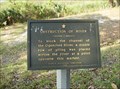 view gallery view gallerySW6.4 km | Obstruction of River Historical Marker in Georgia Historical Markers Obstruction of River Historical Marker at Fort McAllister Historic Site posted by: onfire4jesus location: Georgia date approved: 06/27/2007 last visited: 02/28/2019 |
 view gallery view gallerySW6.4 km | Damage From Naval Bombardments Historical Marker in Georgia Historical Markers Damage From Naval Bombardments Historical Marker at Fort McAllister Historic Site posted by: onfire4jesus location: Georgia date approved: 06/27/2007 last visited: 02/28/2019 |
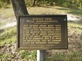
 view gallery view gallerySW6.4 km | Fort McAllister RM 2 - Richmond Hills, GA in U.S. Benchmarks This Reference Mark disk is located on the north wall of Fort McAllister. It is mounted in a concrete block. posted by: onfire4jesus location: Georgia date approved: 04/11/2008 last visited: 02/27/2019 |
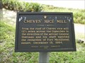 view gallery view gallerySW6.4 km | Cheves' Rice Mill Historical Marker in Georgia Historical Markers Cheves' Rice Mill Historical Marker at Fort McAllister Historic Site posted by: onfire4jesus location: Georgia date approved: 06/27/2007 last visited: 02/28/2019 |
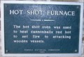 view gallery view gallerySW6.4 km | Hot Shot Furnace Historical Marker in Georgia Historical Markers Hot Shot Furnace Historical Marker at Fort McAllister Historic Site posted by: onfire4jesus location: Georgia date approved: 06/27/2007 last visited: 02/28/2019 |
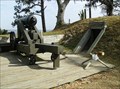
 view gallery view gallerySW6.4 km |  10" Mortar - Fort McAllister - Richmond Hill, GA 10" Mortar - Fort McAllister - Richmond Hill, GA
in Static Artillery Displays This 10" Civil War Mortar was used in the defense of Fort McAllister. It is located in the Fort McAllister State Historic Park near Richmond Hill, GA. posted by: onfire4jesus location: Georgia date approved: 04/10/2008 last visited: 02/28/2019 |
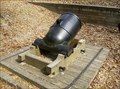
 view gallery view gallerySW6.4 km | 32-Pounder Hot Shot Cannon - Fort McAllister - Richmond Hill, GA in Static Artillery Displays The 32-pounder gun earned its name by aiming heated cannon balls at wooden ships to set them on fire. This one is located at Fort McAllister State Historic Park in Richmond Hill, GA posted by: onfire4jesus location: Georgia date approved: 04/10/2008 last visited: 02/28/2019 |
 view gallery view gallerySW6.4 km |  Battle for Fort McAllister - Richmond Hill, GA Battle for Fort McAllister - Richmond Hill, GA
in Battlefields Fort McAllister was the site of 7 naval battles where the Union Navy tried to capture the Fort. It was finally captured by General Sherman during his march to the sea. The fort is open every day except Christmas 8:00AM-5:00PM. posted by: onfire4jesus location: Georgia date approved: 04/10/2008 last visited: 02/28/2019 |
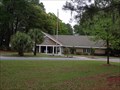
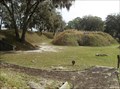 view gallery view gallerySW6.4 km |  Site of Fort McAllister - Richmond Hill, GA Site of Fort McAllister - Richmond Hill, GA
in American Guide Series Fort McAllister State Historic Park is home to the best-preserved earthwork fortification of the Confedracy. The fort is open every day except Christmas 8:00AM-5:00PM. It is located east of Richmond Hill, GA on Fort McAllister Road. posted by: onfire4jesus location: Georgia date approved: 04/10/2008 last visited: 02/28/2019 |
|