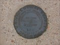
 view gallery view gallery W3.2 km W3.2 km
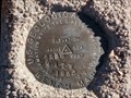
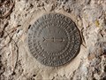
|   4 A.T.W - Elbert County, Colorado 4 A.T.W - Elbert County, Colorado
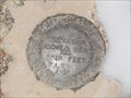
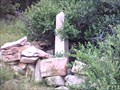
in U.S. Benchmarks USGS Benchmark northwest of Elbert, Colorado. posted by:  Tom.dog Tom.dog location: Colorado date approved: 12/14/2013 last visited: never |
 view gallery view gallery S3.9 km S3.9 km
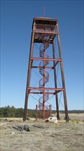
|  Kimsey Tower - Elbert County, CO Kimsey Tower - Elbert County, CO
in Citizen Memorials The Kimsey Tower is located on the grounds of the Peaceful Valley Scouts Ranch. posted by:  condor1 condor1 location: Colorado date approved: 03/07/2011 last visited: 03/06/2011 |
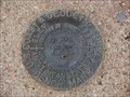
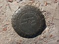 view gallery view galleryW12.6 km | TT 3B (AA3438) - Douglas County, Colorado in U.S. Benchmarks A USGS benchmark located at the intersection of E Cherry Creek Road and Steele Avenue. posted by: Tom.dog location: Colorado date approved: 11/16/2022 last visited: never |
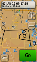 view gallery view galleryW13.2 km |  The "Baker" Pattern The "Baker" Pattern
in GPS Tracklog Art The Baker pattern was used by the US Navy to train pilots during WWII and is still useful today as an exercise to develop and maintain instrument proficiency. posted by: IJAdventures location: Colorado date approved: 01/08/2012 last visited: never |
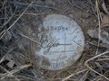
 view gallery view gallery SW14.3 km SW14.3 km
| 2 A.T.W - El Paso County, Colorado in U.S. Benchmarks USGS Benchmark in Northern El Paso County, Colorado. posted by: Tom.dog location: Colorado date approved: 12/11/2013 last visited: never |
 view gallery view gallery NE15.3 km NE15.3 km
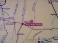
|  You Are Here in Kiowa, CO You Are Here in Kiowa, CO
in 'You Are Here' Maps You Are Here in the town of Kiowa on the eastern plains of Colorado. posted by: condor1 location: Colorado date approved: 04/26/2010 last visited: 06/01/2012 |
 view gallery view galleryNE15.3 km |  Trail Under Seige - Kiowa, CO Trail Under Seige - Kiowa, CO
in Colorado Historical Markers This Historical Marker sits along CO Hwy 86 (north side) adjacent to the Historical Elbert County Courthouse. posted by: condor1 location: Colorado date approved: 07/11/2010 last visited: 06/01/2012 |
 view gallery view galleryS16.3 km |  Homestead Ranch Region Park Playground, El Paso County, Colorado Homestead Ranch Region Park Playground, El Paso County, Colorado
in Public Playgrounds A nice, pretty extensive playground in the New Homestead Ranch Regional Park. posted by: WitzAbout location: Colorado date approved: 04/29/2007 last visited: never |
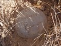
 view gallery view galleryS16.7 km | DIVIDE (KK1646) - El Paso County, Colorado in U.S. Benchmarks A triangulation station from 1879 on top of a small butte about 3.5 miles to the north-northeast of Peyton, Colorado. posted by: Tom.dog location: Colorado date approved: 11/04/2022 last visited: never |
 view gallery view galleryS16.7 km | DIVIDE Reference Mark 1 - El Paso County, Colorado in U.S. Benchmarks The lone reference mark of triangulation station DIVIDE. posted by: Tom.dog location: Colorado date approved: 11/04/2022 last visited: never |
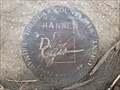 view gallery view galleryW17.4 km | HANNEN (AA3416) - Douglas County, Colorado in U.S. Benchmarks A Douglas County GIS Primary Control Monument in the southwest corner of the intersection of Greenland Road and Dahlberg Road. posted by: Tom.dog location: Colorado date approved: 04/08/2024 last visited: never |
 view gallery view galleryS17.5 km | D 295 (KK0286) - El Paso County, Colorado in U.S. Benchmarks A benchmark disk in the northwest corner of the intersection of Hodgen Road and Meridian Road. posted by: Tom.dog location: Colorado date approved: 11/06/2022 last visited: never |
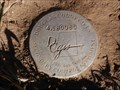 view gallery view gallerySW18.8 km | 4.180060 - Douglas County, Colorado in U.S. Benchmarks Douglas County GIS Secondary Control Monument on County Line Rd. posted by: Tom.dog location: Colorado date approved: 12/22/2013 last visited: never |
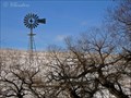 view gallery view gallery N20.1 km N20.1 km
|  Aermotor Windmill Aermotor Windmill
in Windmills Working Aermotor steel tower windmill posted by: IHbinders location: Colorado date approved: 11/05/2011 last visited: 03/06/2021 |
 view gallery view gallerySW20.3 km | 1 BB (KK0282) - El Paso County, Colorado in U.S. Benchmarks A USGS benchmark in the southwest corner of the intersection of Hodgen and Bar X Roads. posted by: Tom.dog location: Colorado date approved: 11/06/2022 last visited: never |
 view gallery view galleryW20.4 km | 4.153034 - Douglas County, Colorado in U.S. Benchmarks Douglas County GIS Secondary Control Monument on Jones Rd. posted by: Tom.dog location: Colorado date approved: 12/22/2013 last visited: never |
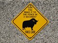 view gallery view galleryW20.6 km |  Yaks Are Fast - Castle Rock, CO Yaks Are Fast - Castle Rock, CO
in Unusual Signs This sign is located at the entrance to the "Organic Yak Farm" about 2 miles west of State Hwy 83 along Lake Gulch Rd. and about 10 miles southeast of Castlerock, CO posted by: condor1 location: Colorado date approved: 08/02/2009 last visited: 04/26/2013 |
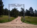 view gallery view galleryW21.1 km |  Spring Valley Cemetery - Larkspur, CO Spring Valley Cemetery - Larkspur, CO
in Worldwide Cemeteries The Spring Valley Cemetery is located about 4 1/2 miles southeast of Greenland and about 10 miles southeast of Larkspur, CO in Douglas county. posted by: condor1 location: Colorado date approved: 08/24/2009 last visited: 06/06/2014 |
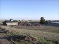
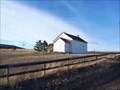 view gallery view galleryW21.4 km |  Spring Valley School - Douglas County, Colorado Spring Valley School - Douglas County, Colorado
in One-Room Schoolhouses A One-Room Schoolhouse at a dirt crossroad. posted by: Big B Bob location: Colorado date approved: 12/17/2009 last visited: 07/03/2016 |
 view gallery view galleryW21.4 km |  Spring Valley School - Douglas County, Colorado Spring Valley School - Douglas County, Colorado
in Former Schools A One-Room Schoolhouse at a dirt crossroad. posted by: Big B Bob location: Colorado date approved: 12/16/2009 last visited: 07/03/2016 |
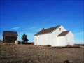 view gallery view galleryW21.4 km |  Spring Valley School - Douglas County, Colorado Spring Valley School - Douglas County, Colorado
in U.S. National Register of Historic Places A One-Room Schoolhouse at a dirt crossroad. posted by: Big B Bob location: Colorado date approved: 12/18/2009 last visited: 07/03/2016 |
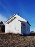
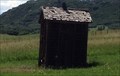 view gallery view galleryW21.6 km |  Outhouse of Spring Valley School - Douglas County, CO Outhouse of Spring Valley School - Douglas County, CO
in Outhouses This One-Seater Outhouse sits on grounds of the old Spring Valley School Acreage. posted by: condor1 location: Colorado date approved: 07/04/2016 last visited: 07/03/2016 |
 view gallery view gallery NW22 km NW22 km
|  Conrad Moschel - Douglas County, CO Conrad Moschel - Douglas County, CO
in Out of Place Graves Here Lies Conrad Moschel - This Out-of-Place marker is buried (Ha Ha), in the Colorado back country. posted by: condor1 location: Colorado date approved: 08/10/2009 last visited: 04/26/2013 |
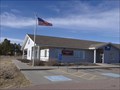 view gallery view galleryS22 km |  Peyton, Colorado 80831 Peyton, Colorado 80831
in U.S. Post Offices Where Colorado Highway bends from East-West to South-West North-East, is the little town of Peyton. posted by: WitzAbout location: Colorado date approved: 11/17/2008 last visited: 05/14/2014 |
 view gallery view galleryW22 km | 4.165028 - Douglas County, Colorado in U.S. Benchmarks Douglas County GIS Secondary Control Monument on Lorraine Rd. posted by: Tom.dog location: Colorado date approved: 12/22/2013 last visited: 06/06/2014 |
|