 view gallery view gallery SW8.7 km SW8.7 km
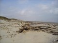
|   North Beach Campground -- Padre Island National Seashore nr Corpus Christi TX North Beach Campground -- Padre Island National Seashore nr Corpus Christi TX
in Free Campsites It is free to camp at the North beach campground at the Padre Island National Seashore (PINS) for up to 2 weeks. The waymark coordinates are for the Malaquite Beach Visitor Center. posted by:  Benchmark Blasterz Benchmark Blasterz location: Texas date approved: 05/21/2014 last visited: 10/23/2023 |
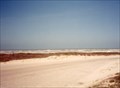
 SW9.3 km |  Padre Island National Seashore Texas Padre Island National Seashore Texas
in Free Overnight RV Parking Locations Free on the beach parking. No facilities but access to water and sewer about 2 Mi away. Nearest gas is about 10 Miles. posted by:  kgbinmo kgbinmo location: Texas date approved: 11/21/2005 last visited: 10/23/2023 |
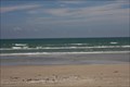
 view gallery view gallerySW9.3 km |  Padre Island - Texas Padre Island - Texas
in National Parks of the World From NPS.GOV:
The National Seashore has a wide variety of opportunities for everyone to enjoy its natural beauty and wonder. Follow the links above for more detailed information on our available activities.
posted by: Geojeepsters location: Texas date approved: 09/02/2009 last visited: 10/23/2023 |
 view gallery view gallerySW9.3 km | ") Padre Island National Seashore - Corpus Christi TX Padre Island National Seashore - Corpus Christi TX
in National Parks (U.S.) The GPS Coordinates are for the Malaquite Visitor Center, Padre Island National Seashore, 20420 Park Road 22, Corpus Christi TX 78418 posted by: Don.Morfe location: Texas date approved: 10/23/2023 last visited: 10/23/2023 |
 view gallery view gallerySW9.3 km |  Padre Island National Seashore - Corpus Christi TX Padre Island National Seashore - Corpus Christi TX
in Wikipedia Entries The GPS Coordinates are for the Malaquite Visitor Center, Padre Island National Seashore, 20420 Park Road 22, Corpus Christi TX 78418. posted by: Don.Morfe location: Texas date approved: 10/23/2023 last visited: 10/24/2023 |
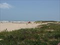
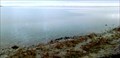
 view gallery view gallerySW9.3 km |  LONGEST - North Padre Island is the longest undeveloped barrier island in the world -Padre Island National Seashore - Corpus Christi TX LONGEST - North Padre Island is the longest undeveloped barrier island in the world -Padre Island National Seashore - Corpus Christi TX
in Superlatives North Padre Island is the longest undeveloped barrier island in the world. The national seashore is 70 miles (110 km) long with 65.5 miles (105.4 km) of Gulf beach. posted by: Don.Morfe location: Texas date approved: 10/25/2023 last visited: 10/26/2023 |
 view gallery view gallerySW9.3 km |  Ranger Station at Padre Island National Seashore - Corpus Christi TX Ranger Station at Padre Island National Seashore - Corpus Christi TX
in Ranger Stations The Ranger Station is inside the Malaquite Visitor Center, Padre Island National Seashore, 20420 Park Road 22, Corpus Christi TX 78418. Here one may obtain a NPS Cancellation Stamp. posted by: Don.Morfe location: Texas date approved: 10/26/2023 last visited: 10/26/2023 |
 view gallery view gallerySW9.3 km |  Padre Island National Seashore - Corpus Christi TX Padre Island National Seashore - Corpus Christi TX
in Satellite Imagery Oddities The GPS Coordinates are for the Malaquite Visitor Center, Padre Island National Seashore, 20420 Park Road 22, Corpus Christi TX 78418 posted by: Don.Morfe location: Texas date approved: 10/23/2023 last visited: 10/24/2023 |
 view gallery view gallerySW9.3 km |  Padre Island National Seashore - Corpus Christi TX Padre Island National Seashore - Corpus Christi TX
in Official Local Tourism Attractions The GPS Coordinates are for the Malaquite Visitor Center, Padre Island National Seashore, 20420 Park Road 22, Corpus Christi TX 78418 posted by: Don.Morfe location: Texas date approved: 10/23/2023 last visited: 10/24/2023 |
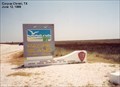
 view gallery view gallerySW9.5 km |  Padre Island National Seashore Padre Island National Seashore
in NPS Passport Cancellation Stations Padre Island National Seashore Cancellation Station. posted by: madamemoutard location: Texas date approved: 01/24/2007 last visited: 10/23/2023 |
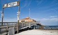 view gallery view gallery N12.9 km N12.9 km
|  Bob Hall Pier at Padre Balli Park -- Corpus Christi TX Bob Hall Pier at Padre Balli Park -- Corpus Christi TX
in Metal Detecting Most of Padre Island is a U. S. Natl Seashore. Metal detecting is PROHIBITED.
But Padre Balli Park is 1 of a few spots on the island where metal detecting is legal. Still be careful here: TX law prohibits digging up artifacts over 100 years old. posted by: Benchmark Blasterz location: Texas date approved: 11/03/2012 last visited: 01/09/2021 |
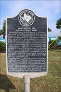 view gallery view galleryN13.5 km |  Padre Island and Padre Nicholas Balli Padre Island and Padre Nicholas Balli
in Texas Historical Markers The state historic marker for the namesake of Padre Island at the entrance to the park that is also named for him posted by: Benchmark Blasterz location: Texas date approved: 01/30/2022 last visited: 02/22/2022 |
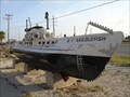 view gallery view galleryN16.9 km |  RV Needlefish - Corpus Christi Texas RV Needlefish - Corpus Christi Texas
in Landlocked Boats This poor sub is just sitting here rusting away. posted by: Geojeepsters location: Texas date approved: 06/28/2009 last visited: 12/25/2020 |
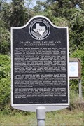 view gallery view galleryN17.7 km | Coastal Hide, Tallow, and Packing Industries in Texas Historical Markers One of two state historical markers at Packery Channel Park on Padre Island posted by: Benchmark Blasterz location: Texas date approved: 01/22/2022 last visited: 01/26/2022 |
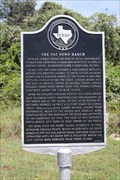 view gallery view galleryN17.7 km | The Pat Dunn Ranch in Texas Historical Markers The second of two state historical markers at Packery Channel Park posted by: Benchmark Blasterz location: Texas date approved: 01/28/2022 last visited: 02/22/2022 |
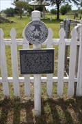 view gallery view galleryN20.9 km | Duncan Cemetery in Texas Historical Markers The state historical cemetery marker for Duncan Cemetery, right next to Flour Bluff Junior High School. posted by: Benchmark Blasterz location: Texas date approved: 01/21/2022 last visited: 01/21/2022 |
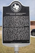 view gallery view galleryN21.4 km | Flour Bluff Independent School District in Texas Historical Markers The state historical marker for the Flour Bluff ISD posted by: Benchmark Blasterz location: Texas date approved: 01/28/2022 last visited: 02/22/2022 |
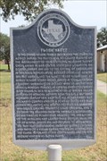 view gallery view galleryN22.9 km | Flour Bluff in Texas Historical Markers The marker is located in the small rest area.
Sometime in 2018, the marker was moved. posted by: Deafdillos location: Texas date approved: 11/20/2006 last visited: 01/26/2022 |
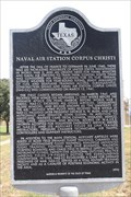 view gallery view galleryN22.9 km | Naval Air Station Corpus Christi in Texas Historical Markers One of three markers at this Flour Bluff park, this particular marker relates the history of the Naval Air Station at Corpus Christi, Mama Blaster's last official Navy duty station. posted by: Benchmark Blasterz location: Texas date approved: 01/29/2022 last visited: 02/22/2022 |
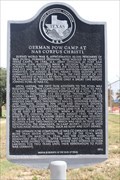 view gallery view galleryN22.9 km | German POW Camp at NAS Corpus Christi in Texas Historical Markers Second of three markers at this Flour Bluff park, this marker preserves the history of the German POW Camp at NAS Corpus Christi during WWII posted by: Benchmark Blasterz location: Texas date approved: 01/29/2022 last visited: 02/22/2022 |
 view gallery view galleryN25.7 km |  Naval Air Station MIA Memorial, Corpus Christi, TX, USA Naval Air Station MIA Memorial, Corpus Christi, TX, USA
in Vietnam POW/MIA Monuments Vietnam era Missing in Action memorial in Shields Park, on Naval Air Station Corpus Christi. posted by: HANSENNI location: Texas date approved: 01/30/2010 last visited: never |
 view gallery view gallery NW26.9 km NW26.9 km
| Sunshine Cemetery in Texas Historical Markers The state historical marker for Sunshine Cemetery on Wooldridge Rd in south Corpus Christi posted by: Benchmark Blasterz location: Texas date approved: 01/29/2022 last visited: 02/22/2022 |
 view gallery view galleryNW28 km |  South Texas Botanical Gardens, Corpus Christi, Texas South Texas Botanical Gardens, Corpus Christi, Texas
in Botanical Gardens If you tire of the sea and sand while in Corpus, head over here for a few hours, wandering through flower gardens, a cacti garden, greenhouses (one devoted to orchids), and on a hiking trail through native grasses, wetlands and scrub. posted by: JimmyEv location: Texas date approved: 06/08/2007 last visited: 04/03/2016 |
 view gallery view galleryNW29.5 km |  Suter Wildlife Refuge - Corpus Christi, Texas Suter Wildlife Refuge - Corpus Christi, Texas
in Municipal Parks and Plazas The wildlife refuge features a boardwalk into Oso Bay, a 1-mile nature trail along the shore in chaparral, and a few geocaches. posted by: JimmyEv location: Texas date approved: 07/06/2007 last visited: 04/03/2016 |
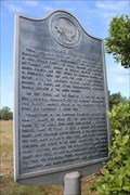
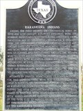 view gallery view galleryNW29.5 km | Karankawa Indians in Texas Historical Markers The Karankawa Indians, a nomadic tribe native to the Texan coast, were destroyed by European colonization. The Corpus Christi Museum of Science and History has an excellent exhibit on the Karankawas. posted by: JimmyEv location: Texas date approved: 05/05/2007 last visited: 01/21/2022 |
|